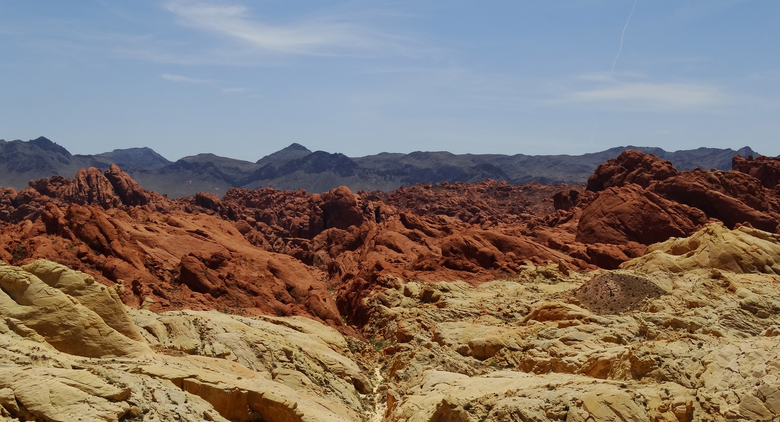
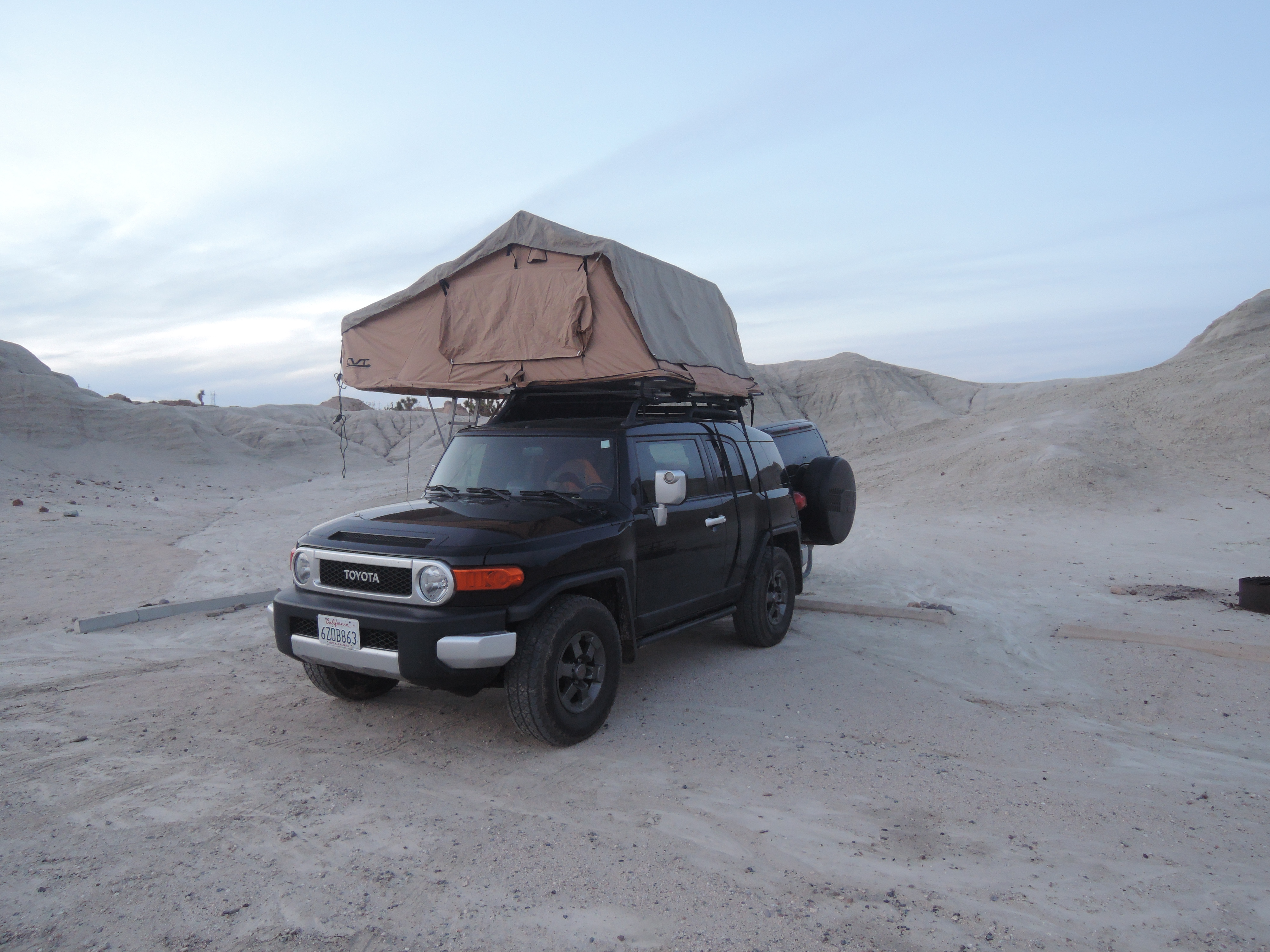
We finally made it to the Valley of Fire! It has been on our itinerary for many years as someplace that we wanted to visit while in Las Vegas. Unfortunately, we never had a car while in Las Vegas and we just didn’t make it a priority. Well, this time, we had our FJ and a tent so we could actually spend a few days exploring the area and it was definitely worth the stop.
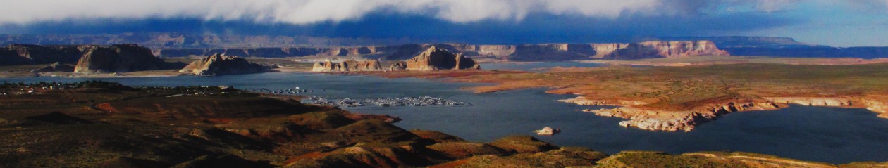
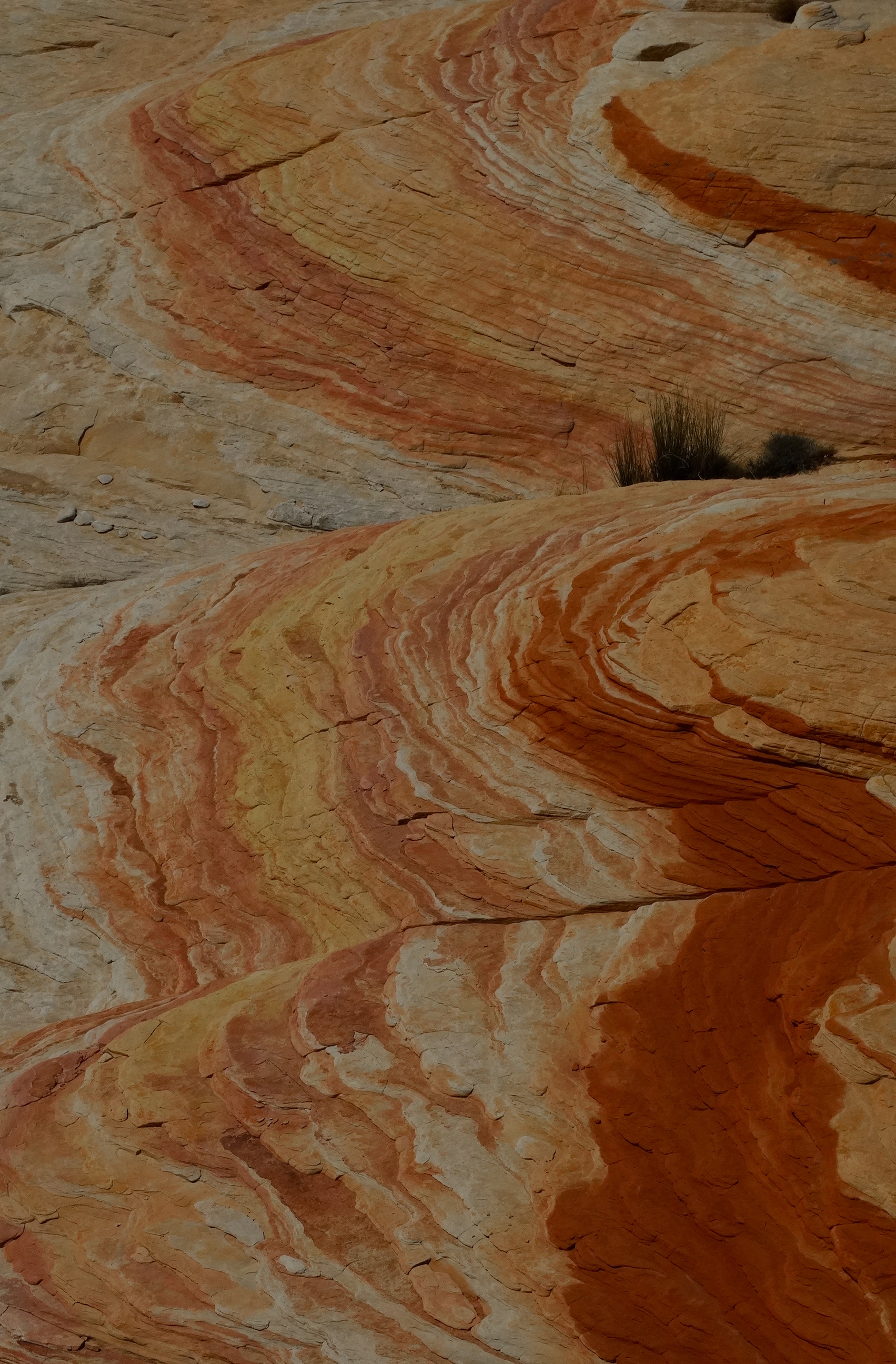
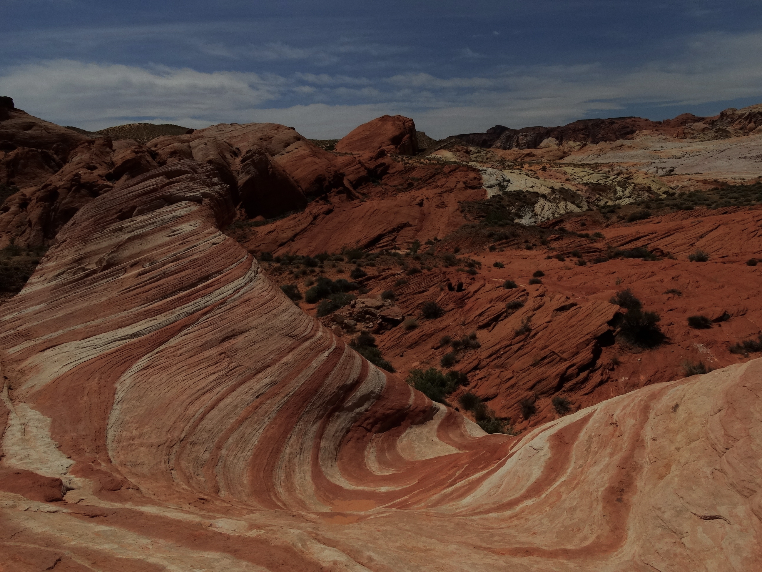
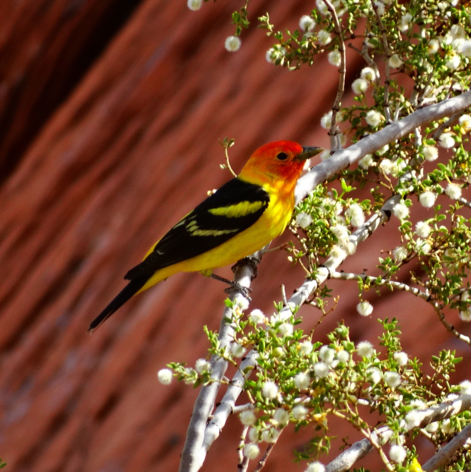
We arrived late in the evening which makes waking up in the morning a great surprise since we never know how the scenery will look in the day light. The Valley of Fire lives up to its name. It’s all aglow with sandstone formations of varying shades of red. Over breakfast we were entertained by a family of sparrows whose home happened to be in our picnic area.
Insects for breakfast anyone?!
We camped at Atlatl Rock campground while there. It’s a very nice campground with flush toilets and showers. Showers are always a real plus and flush toilets…don’t get me started! Many of the bathroom facilities at our state and national park campgrounds are the bare minimum.
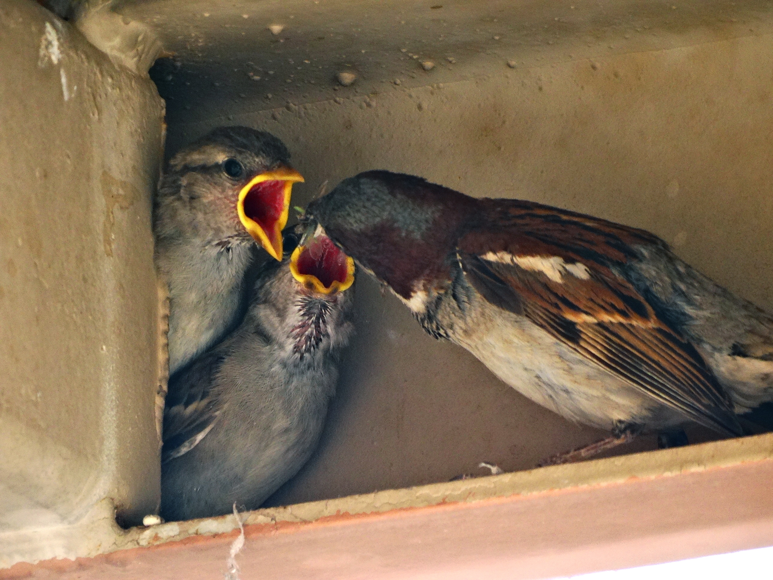
Our first hike of the day was along “Mouse Tank” trail named after a South Paiute Indian named “little mouse”. He hid in this area after being accused of killing two prospectors which I’m sure is just one side of the story. There is a natural basin, or “mouse tank”, at the trail’s end where rain water can be found giving the trail its name. There were a number of petroglyphs along the trail made by the Basket Maker people and the Anasazi Pueblo Farmers.
These were very simple petroglyph designs.The big horned sheep depicted here were the only traces of big horned sheep that we have seen all throughout our desert travels.
We saw two other couples on the trail and one of the men couldn’t keep his hands off the petroglyphs. It was driving me nuts that this guy had no respect for the artifacts and was either completely unaware or didn’t care that his actions were degrading these artifacts. We think our small actions have no impact but look at the aggregate effect we’ve had on this land and it’s devastating.
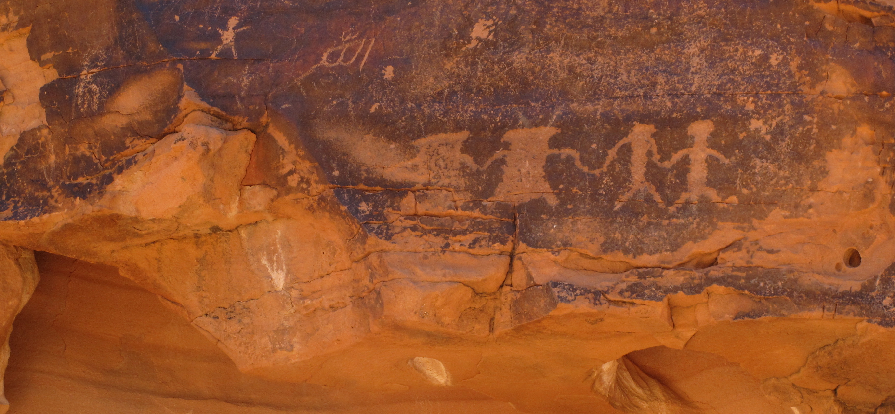
Now onto something much more entertaining, the chuckwalla. Before this trip, I thought that chuckwallas were cute furry little creatures. I couldn’t be more wrong.
Chuckwalla basking in the sun.
These lizards were all throughout the Valley of Fire and were happy to pose for me whenever I came across them even when they were busy eating their lunch.
Lunchtime
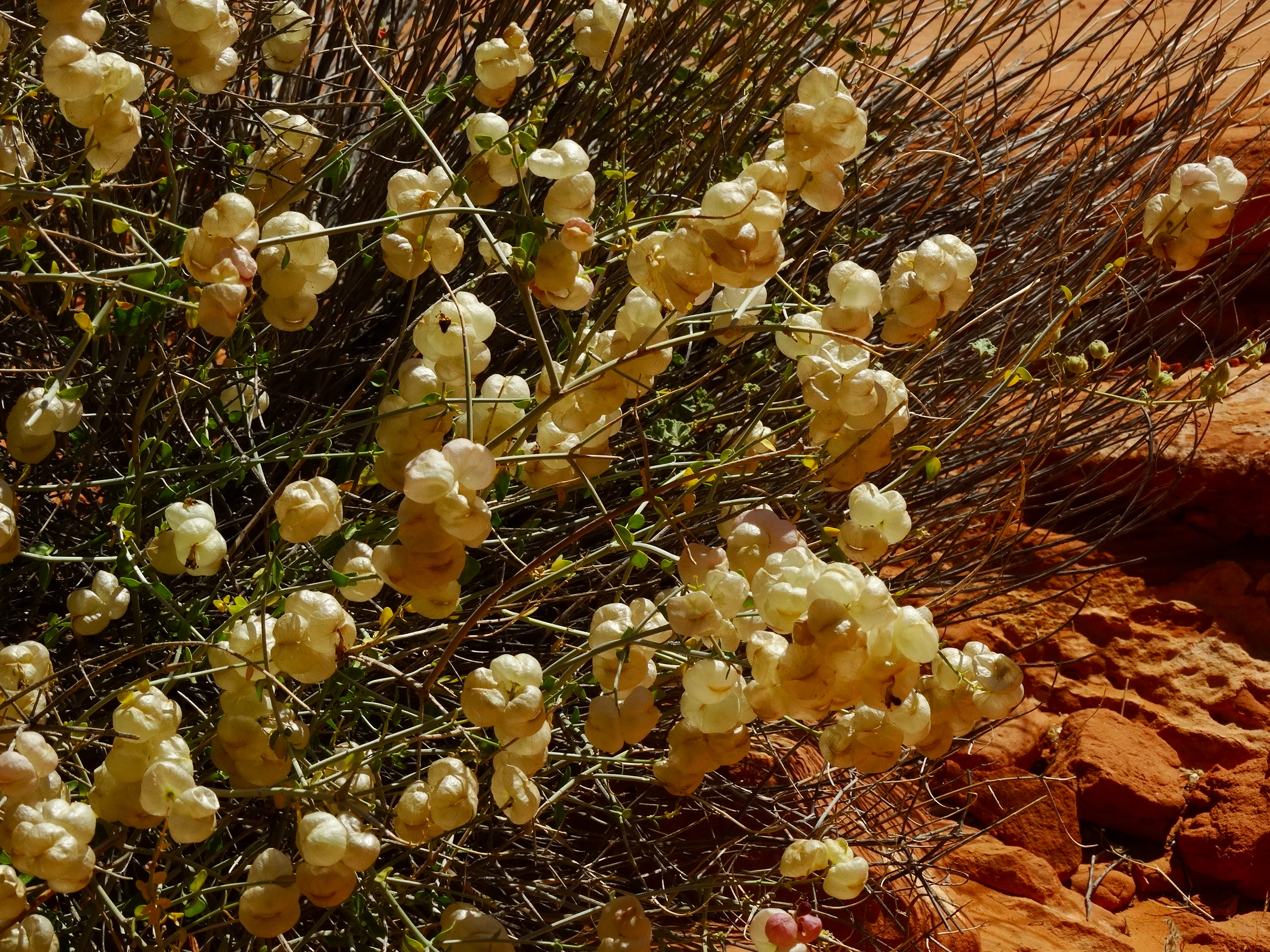
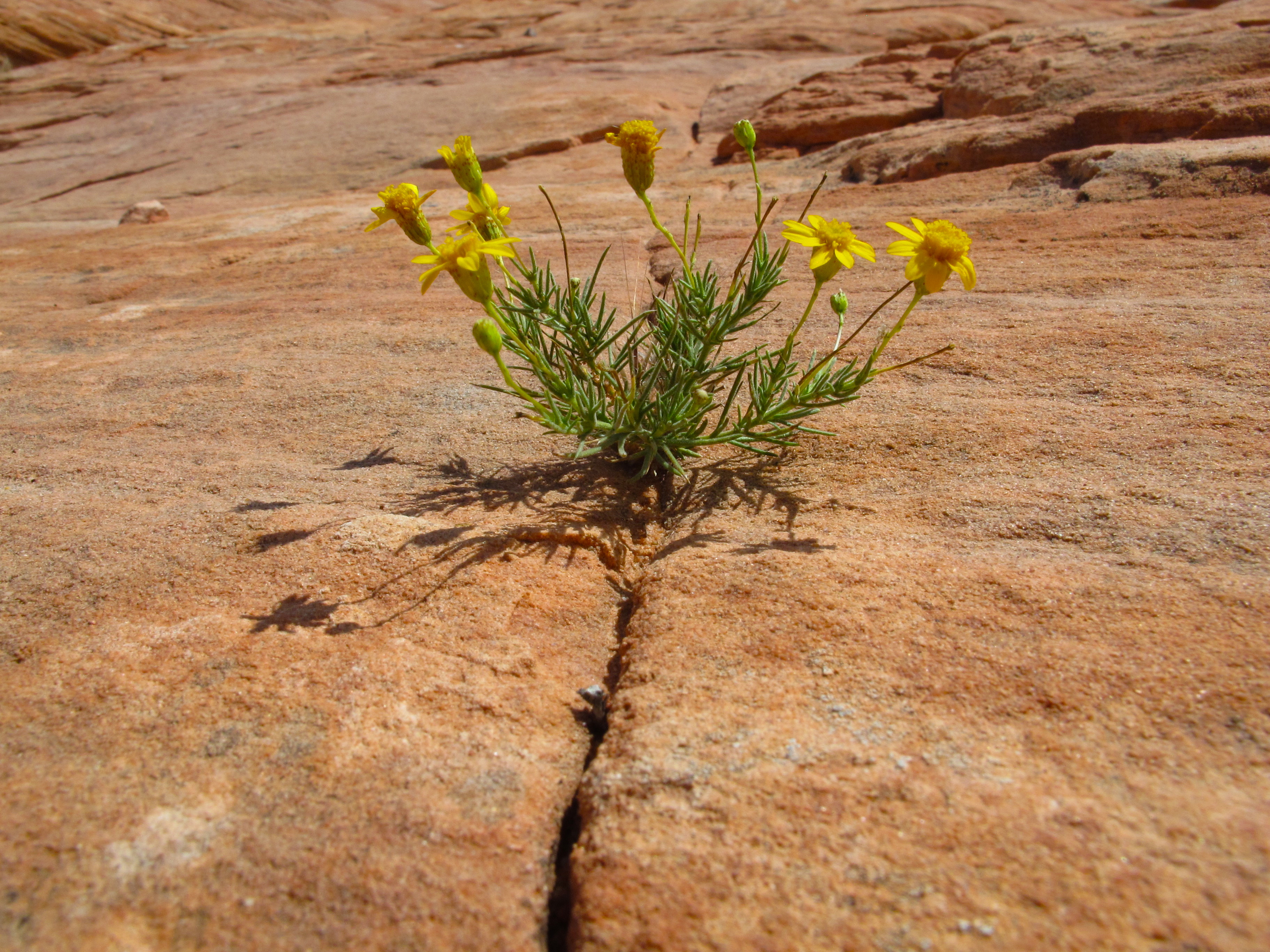
The whole valley seemed to be in bloom. Darryl was patient with me as I lagged behind taking photograph after photograph of the beautiful flowers. I couldn’t get over the beauty of these displays of color in the parched desert. The desert may look uninviting and without life but if you take the time to really explore it, you’ll be rewarded for the effort.
I loved how this plant’s stems mirrored the lines in the sandstone.
This was my favorite flower. It’s a paper-bag bush. These pods are tissue paper thin and contain the plant’s seeds. The bags are carried away by the winds to scatter the seeds.
Paper-bag bush or Bladder SageMinimalist survival
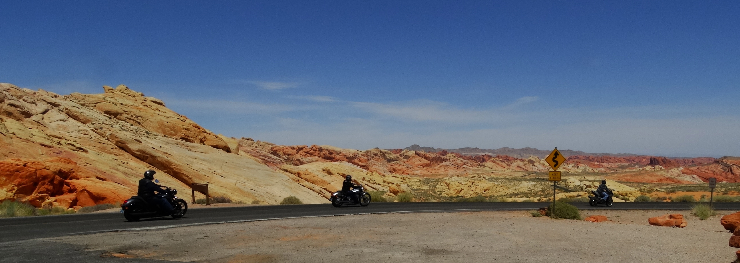
I chatted with this woman from Las Vegas about her bike. Darryl and I have our motorcycle licenses but we put off the motorcycle purchases until after the trip. I love these larger bikes so every time I have a chance to chat with a woman who is on a bike I take the opportunity to find out what she thinks of her choice. This woman has only had her bike for 8 months and feels that she’s outgrown it. She wants a larger bike for the stability on the road, especially on windy days.
Although born and raised in Las Vegas, this is her first time in Valley of Fire and she’s loving it!Out on a Sunday ride through Valley of Fire.
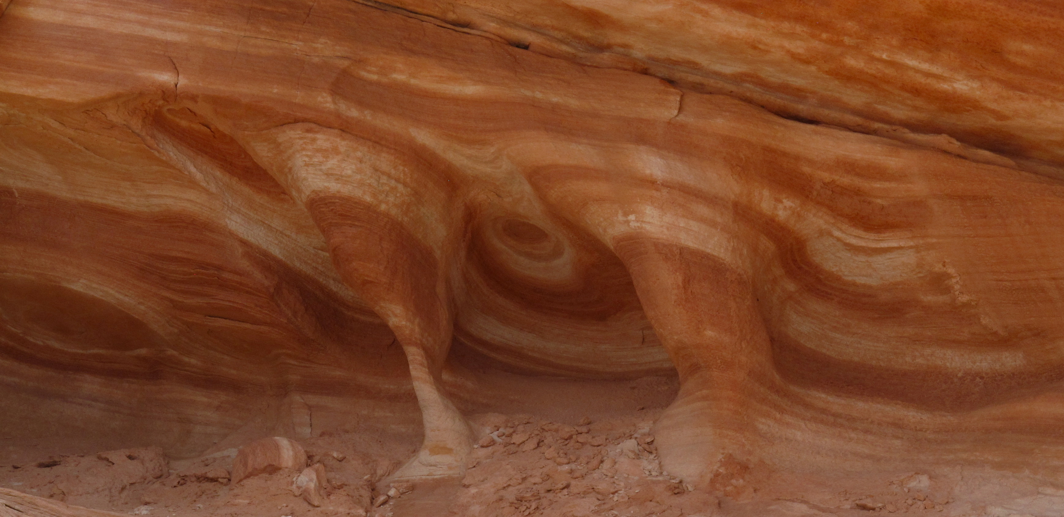
The sandstone looked like pulled taffy along Rainbow Vista Trail. We didn’t have to walk far to see these beautiful features. This particular trail was only a mile long. The other trails were just as short or shorter making this a very accessible park for people of all ages and abilities. Although it’s a small park, we never felt like it was crowded. On this particular trail we saw only 3 other people.
The colors across the landscape were gorgeous!A self portrait
We moved to another campsite within Atlatl Campground where we watched this beauty during breakfast the following morning.
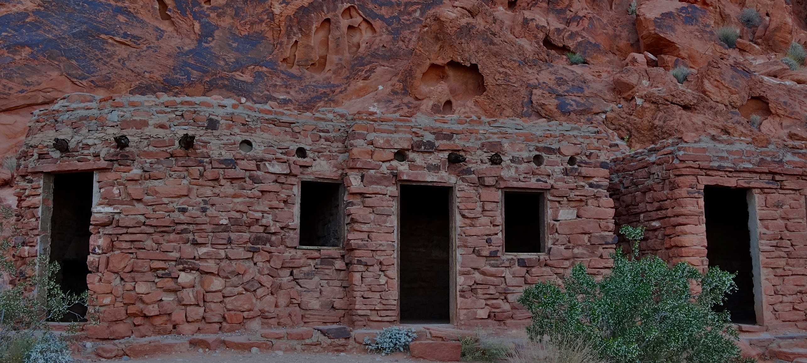
These cabins were built by the Civilian Conservation Corps (CCC) in 1936 just after the park was first established. They were built as shelter for hikers and campers that visited the park. Now they are preserved as a reminder of the CCC’s contribution to our park systems.
Made of native sandstone by the CCC.
Our second day at the park was spent mostly driving around admiring the beauty. This was taken at Rainbow Vista look-out point.
Rainbow vista
I thought that it was very important that we get out and walk the short trail to see the petrified logs. I have no idea why petrified wood is such a fascination for me but it is and it has been since I was a child. The trail was only 0.3 of a mile and this was my reward.
Petrified log partially uncovered.
I think that I was expecting more and Darryl got a good laugh at the my underwhelming response. I spent a good five minutes trying to find the best angle to photograph this artifact which was surrounded by a chain link fence. I finally gave in to the realization that there was no good angle. So then I set my sights on the other chain link fences off in the distance since I was absolutely confident that they must contain something grander! They didn’t.
We drove by “Lone Rock” which was a very large block of sandstone. I think that the marketing people were really stretching their creative juices on this one. “Elephant Rock” was a bit more interesting.
Elephant Rock
Sometimes you should just let nature speak for itself. This was our lovely sunset view near the petrified logs.
The last time I visited Hoover Dam was with my parents about 12 years ago. I was surprised to see all of the changes with the new Hoover Dam Bypass which is named the Mike O’Callaghan – Pat Tillman Memorial Bridge. Mike O’Callaghan was a Korean War Veteran, the Governor of Nevada from 1971-1979 and the editor of the Las Vegas Sun newspaper. Pat Tillman gave up a multi-million dollar contract with the Arizona Cardinals and enlisted as an infantryman in the US Army. He was killed by friendly fire during the war in Afghanistan in 2004.
All US 93 traffic now uses the Hoover Dam Bypass rather than driving over the Hoover Dam. This eliminates the traffic congestion created by the heavy commercial and visitor traffic that would wind through the sharp turns of the former US 93 route that passed over the Hoover Dam. The bypass bridge has a nice pedestrian sidewalk with an interesting display detailing the construction of the Mike O’Callaghan – Pat Tillman Memorial Bridge. The view from this bridge is impressive. Visitors now access Hoover Dam by parking either in the parking garage or in one of the parking lots along the old US 93 route and then walking to the Hoover Dam.
Mike O’Callaghan – Pat Tillman Memorial Bridge
Another change since my last trip was the enhanced security for tourists that enter the area. All vehicles accessing the visitor parking area are subject to a search. I must say that this was the most comprehensive yet efficient search that we have experienced yet. It was actually done with some intelligence compared to our experience in Baja and along the US/Mexico border. The Baja military checks were just a cursory look into the vehicle and somebody would usually look at the maps or books behind my passenger seat. The US border patrol didn’t do much more than ask us ‘where are you going’ and ‘from where did you come’. They barely even looked at our passports! But here, at Hoover Dam, they asked us to unzip our roof top tent, they opened up the back of the vehicle, they asked about the inverter and looked inside our cooler and inside most of the boxes in the back of our car. It was all completed in about 2-3 minutes.
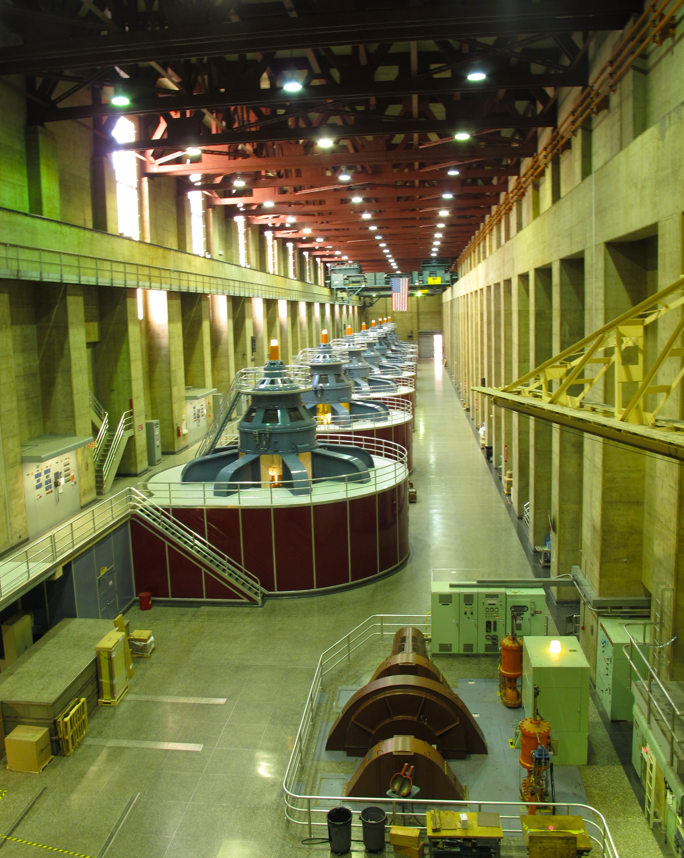
View from the new bypass bridge.View of the facilities behind the Hoover Dam.Approaching the dam from the parking area. These are the huge intake towers that power the massive generators.
We took the Dam Tour to learn about the inner workings of the dam and see how the hydro-electric power was generated. I think that the Powerplant Tour would have been more informative but we missed the last one for the day. Although the Dam Tour was interesting, it felt like the tour guide was reciting from a memorized script. He wasn’t able to really answer any of the questions from the group. It was still impressive to see the inside of the dam.
Schematic of how the hydro-electric power is generated.Francis-turbine generatorsTaken in 1983, this was only the second time that the spillway was used (due to a flood). The first time was just to test the spillway.
More than 5 million barrels of concrete were used to build the dam; enough concrete to build a two lane highway from Seattle, WA to Miami, FL.
At its base, the maximum water pressure is 45,000 pounds / square foot
The building of the dam created Lake Mead, one of the largest man-made lakes in the world with 550 miles of shoreline over an area of 247 miles.
She was happy to pose for my camera while the professional took a break.
After our day at Hoover Dam, we returned to Boulder Beach where we were camping and went out for a short run along the Railroad Tunnel Trail. Because of the light, I couldn’t get a good photo of the tunnels, but here is one of the views that we enjoyed at the campground.
Sunset run along Railroad Tunnel Trail.
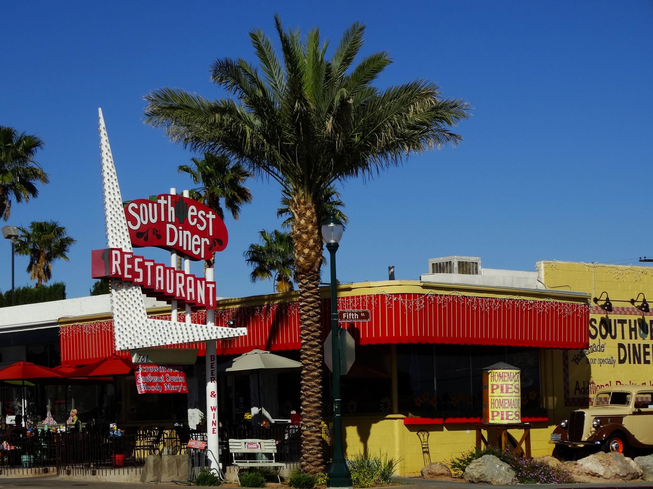
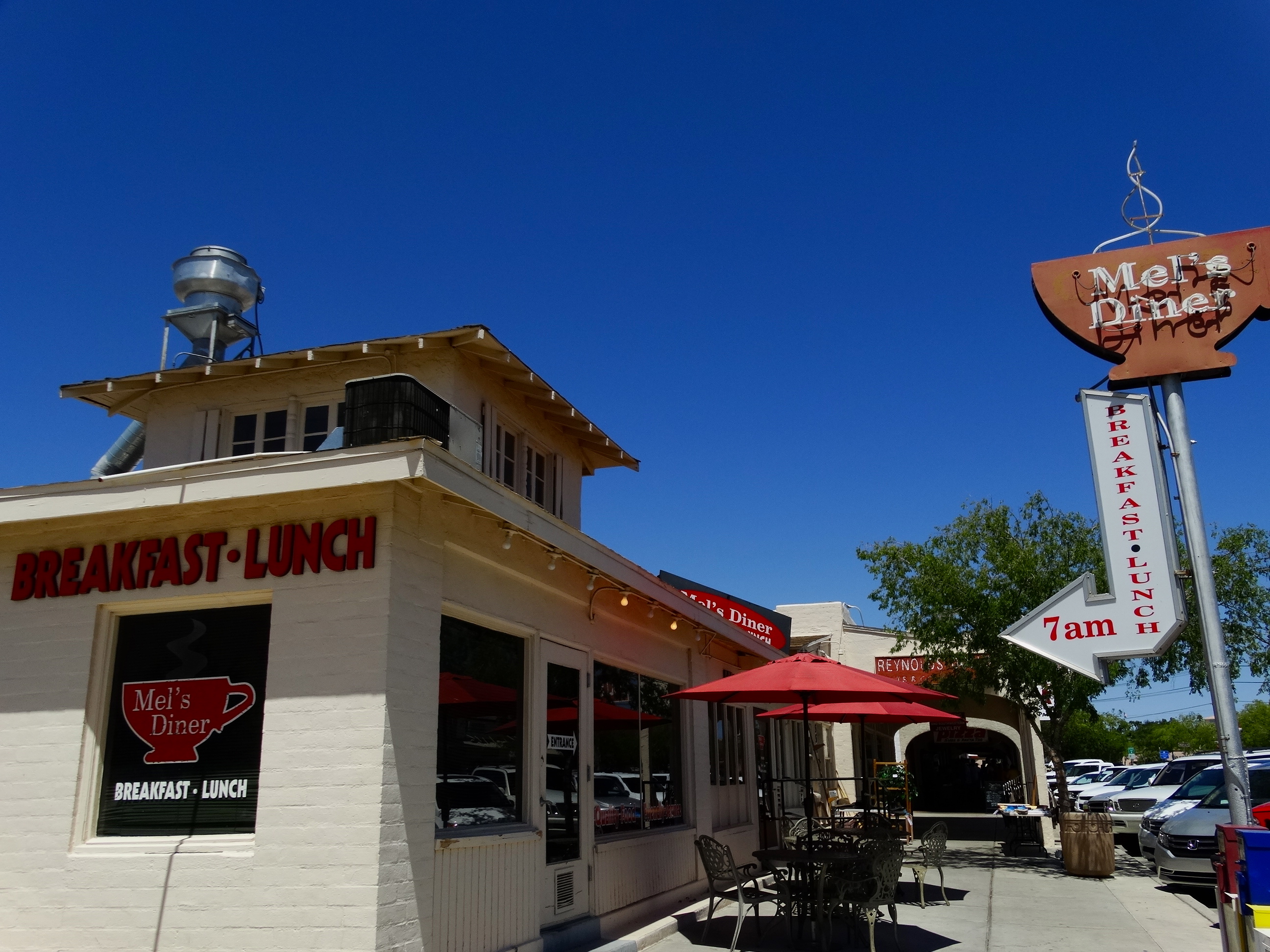
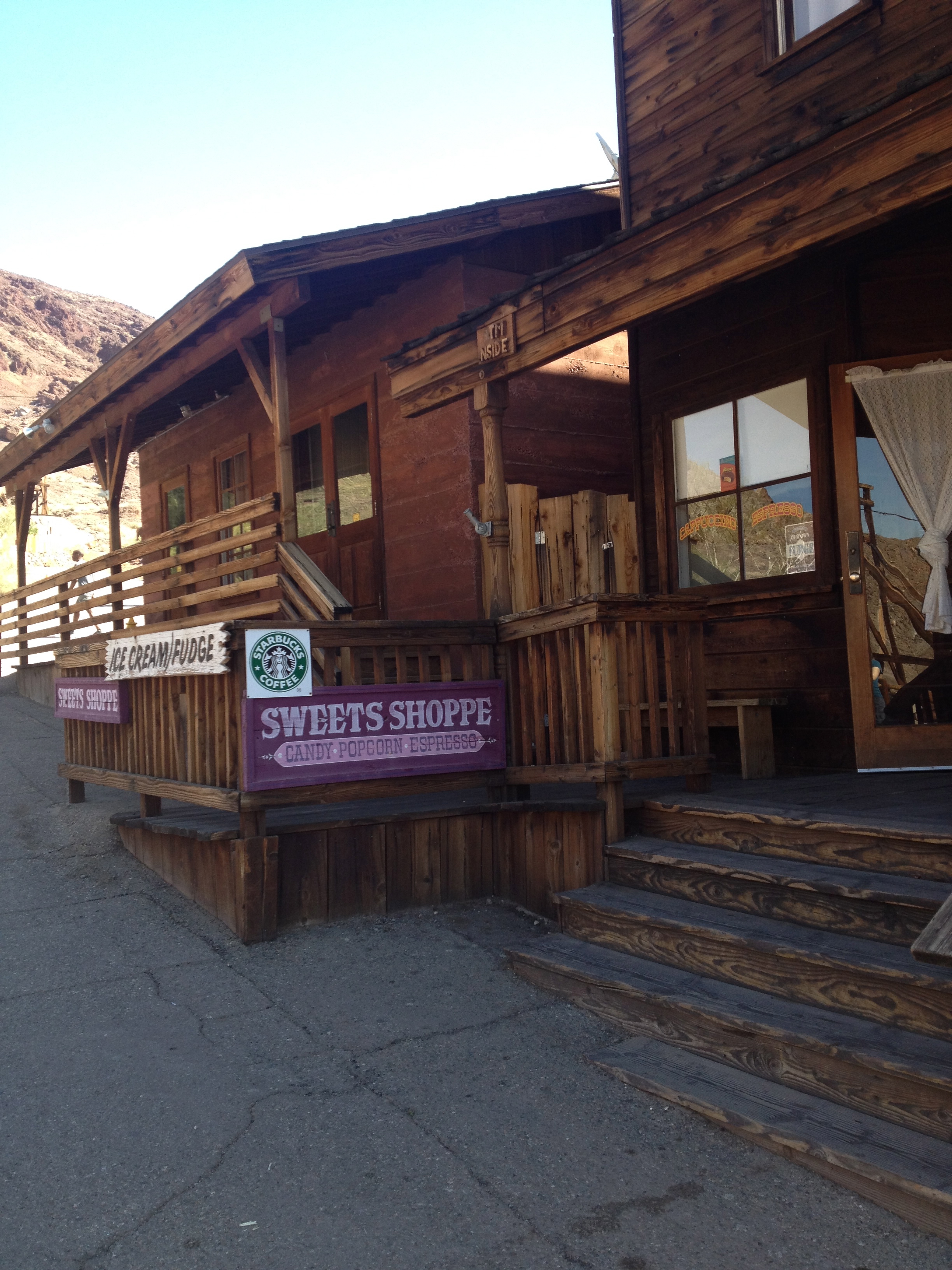
The next day we went into the town of Boulder City. The town was created to lodge the thousands of workers and their families that came to work on Hoover Dam. They never expected that the town would survive after the completion of the dam but there is a small, thriving community of 15,000 that depends upon tourists although it’s only one of two towns in Nevada that doesn’t allow gambling. We spent just a short time here. Just long enough to take a few photos of the old storefront signs, have lunch and for Darryl to stop at the only barber shop in town.
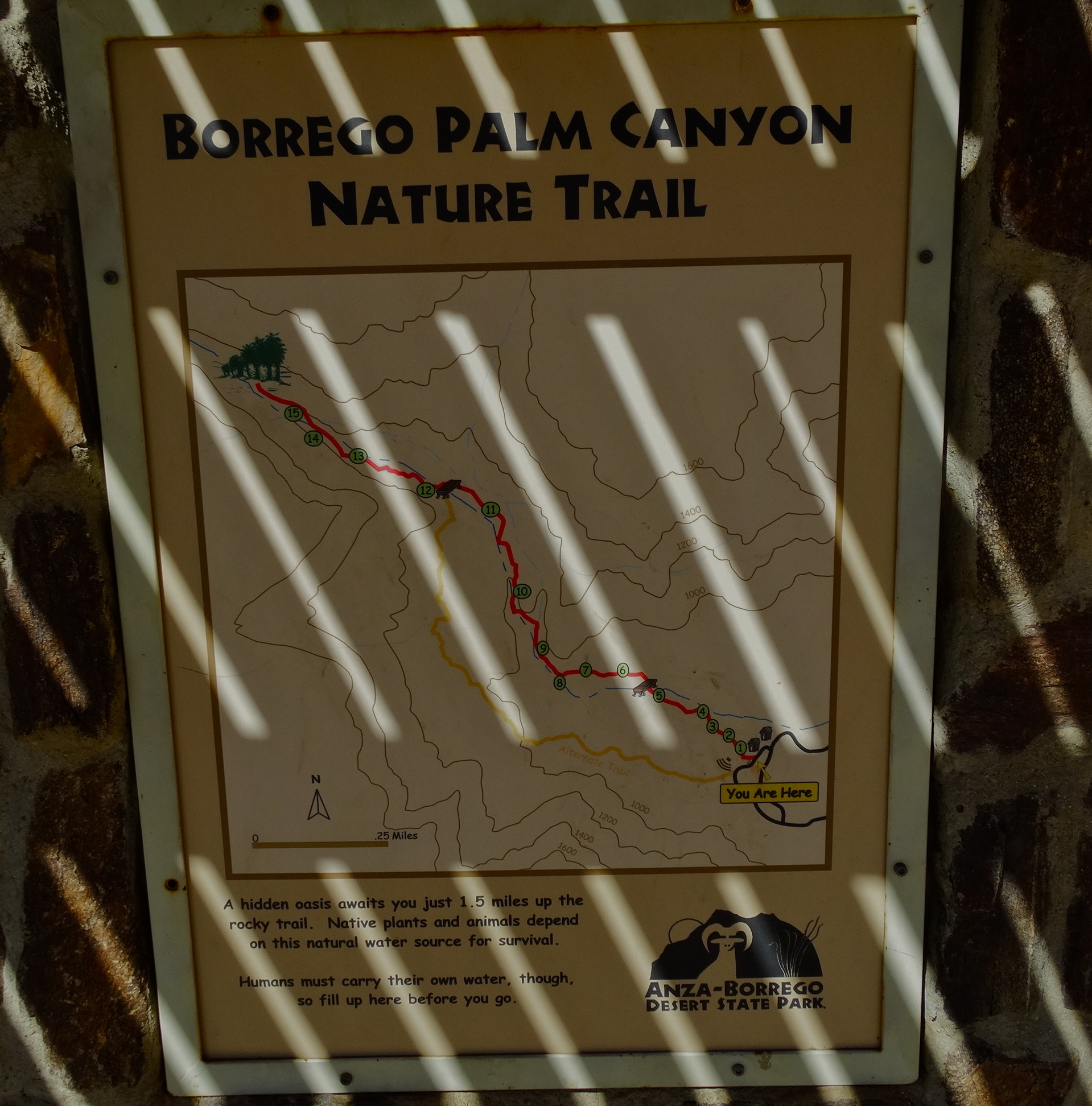
We only spent a day in Anza-Borrego but this park deserves much more time than we gave it. We arrived late so had a quick dinner and then we set out for an evening hike in the moonlight.
Palm oasis silhouette at sunset.
The next morning, we took our time with breakfast and eventually made it out for a short hike. The nature trail included a self-guided tour with numbered posts along the way pointing out various plants and interesting points along the trail.
Our morning hike.
It was in the mid-90’s during our hike and completely exposed. We could see the oasis off in the distance but we were walking through this beautiful desert landscape.
Our destination off in the distance.
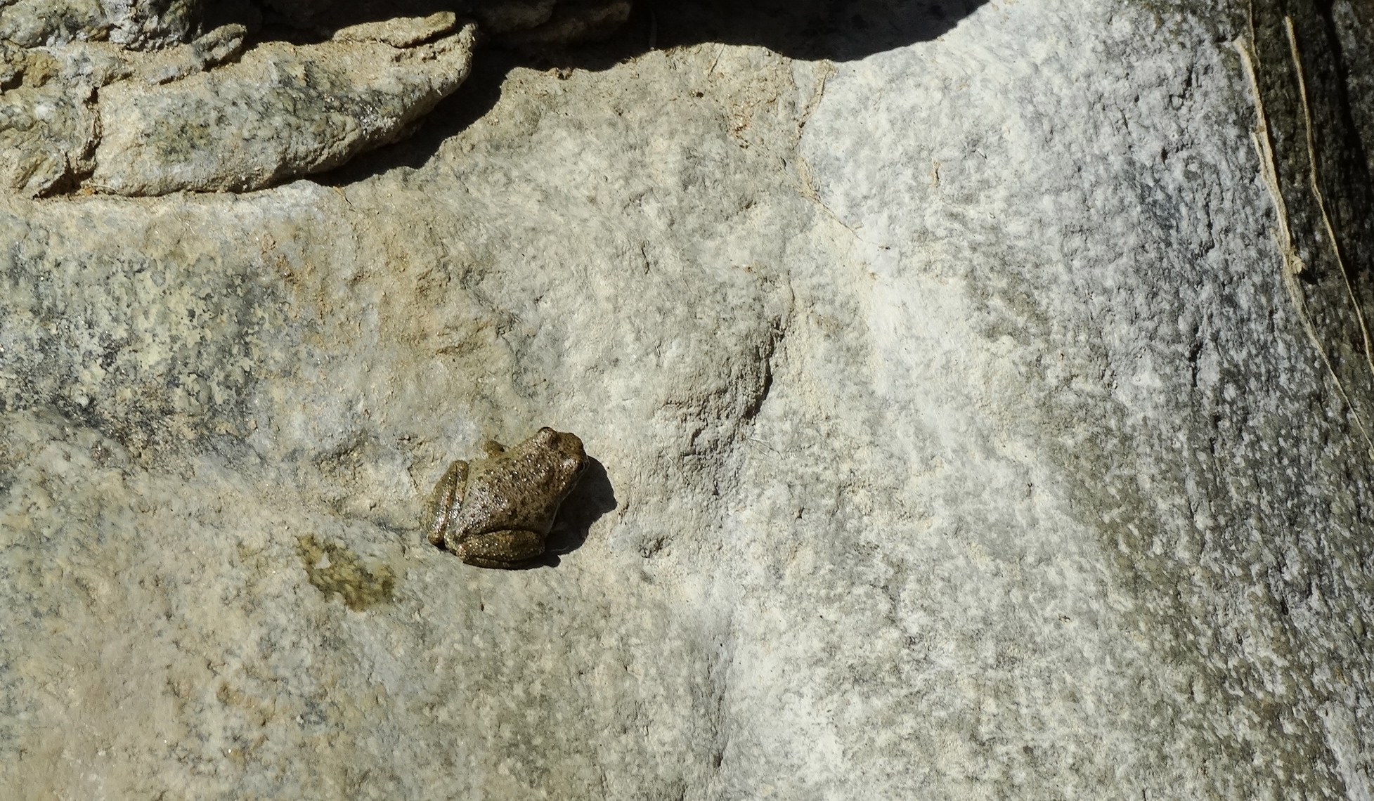
I kept looking up in the hills hoping to see the elusive big horned sheep but I never saw one. We continue to see signs along our travels telling us that there are small herds of big horned sheep in the area but we have yet to see any. I need to invest in some binoculars and then perhaps I could find one! All I found along the way were these beautiful lizards and one tiny toad.
We saw a bunch of these guys. I loved their brilliant colors.A rare treat to see a toad along the trail!
Anyone that has been out on a trail, in a car or on a bike ride with me understands my very limited directional skills. This is perhaps why my loving husband felt it necessary to tell me which direction to head even though the state park had a sign posted as well.
A note left for me by my loving husband. Can you see it?
Our destination! It was worth the short 1.5 mile hike to get here. We spent a short time wandering through the oasis and enjoying the shade. There was a stream through here that ran over some boulders creating little waterfalls. We turned around at this point but you can continue up the canyon where there are hundreds of palms throughout. It’s a beautiful juxtaposition of green against the desert landscape. There’s much to explore here which will have to wait for another visit.
Amazing to see a palm oasis in the middle of the desert.
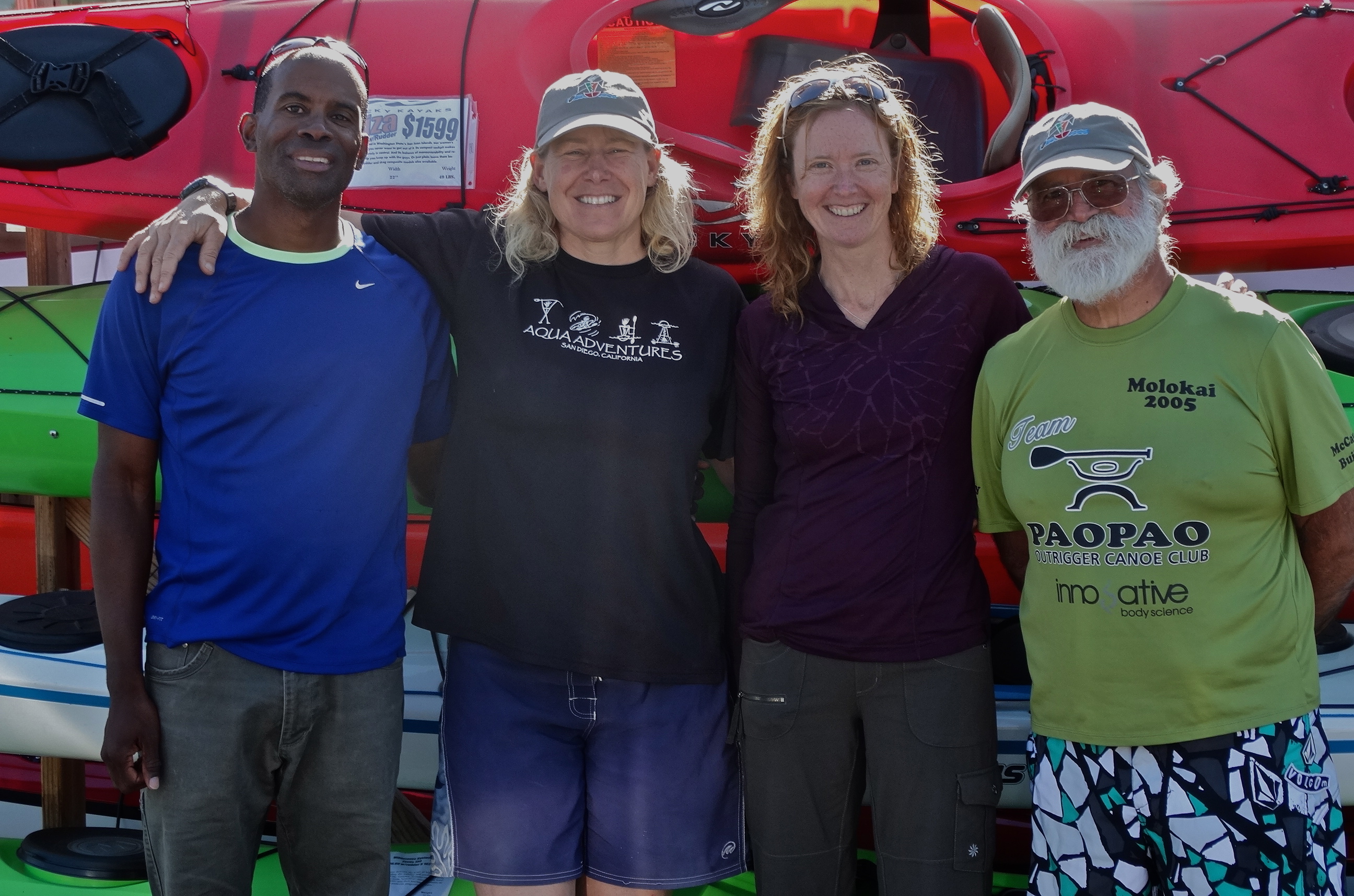
After our two kayaking experiences in Baja we decided that it would be wise for us to take some kayaking lessons to gain some proficiency in this sport. We really enjoyed our time on the water but we spent a lot of energy during these short trips. Since it’s a sport that we’re interested in pursuing we decided to invest a little time and money getting some tips from an expert. We found our expert at Aqua Adventures Kayak Center in San Diego. Jen Kleck, the owner, was our awesome instructor with Paul as her co-instructor. Jen is a patient instructor with an impressive background. In 2009 she was the first American to reach the highest coaching standard within the British Canoe Union. We had a great time out on the water learning various paddling strokes for steering, bracing and propulsion. We also learned some very important skills related to capsize recovery. I’m pretty confident that Darryl or I will tip over at some point giving us the opportunity to put this particular skill to the test. Darryl scored extra points by doing a double capsize recovery where both kayakers tip into the water and have to recover both kayaks and paddlers. I learned how to do a self-recovery by using my paddle with a flotation devise attached to the end of it as a brace and pulling myself into the kayak. Our lessons were in a protected marina setting so now we need to practice these recovery techniques in a real world situation out on choppy, moving water.
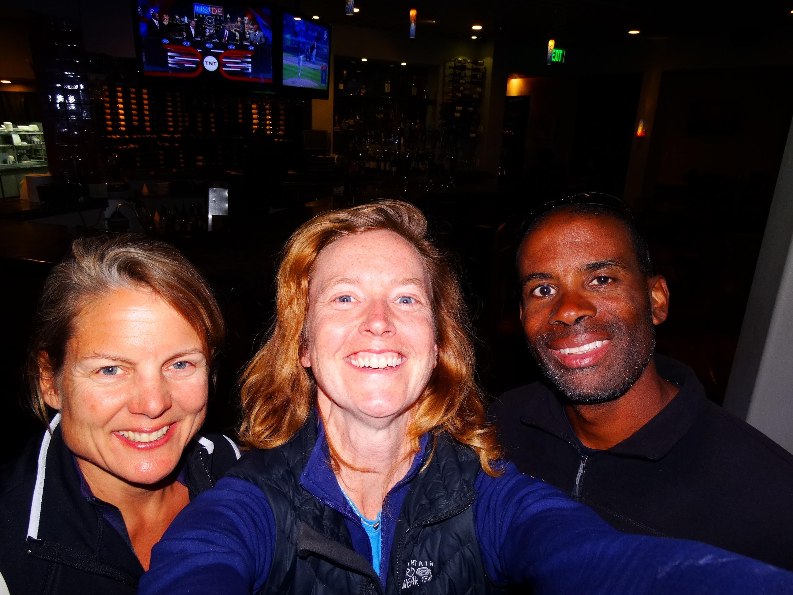
With Jen and Paul after our day of kayaking lessons at Aqua Adventures in San Diego.
After our lessons, we spent some time exploring the San Diego area and driving along the coast up to La Jolla. We really enjoyed out time in San Diego. We camped at Campland on the Bay which is an RV type of campground that allowed tent camping. It was nice to have hot showers every night although we camped on the asphalt in the parking lot. The campground is just a few blocks from Pacific Beach so we spent a few days exploring the neighborhood and walking along the coast.
If only I could fly!!These beaches are gorgeous.At play with the sea lions.Harbor seals at Casa Beach in La Jolla, CA.
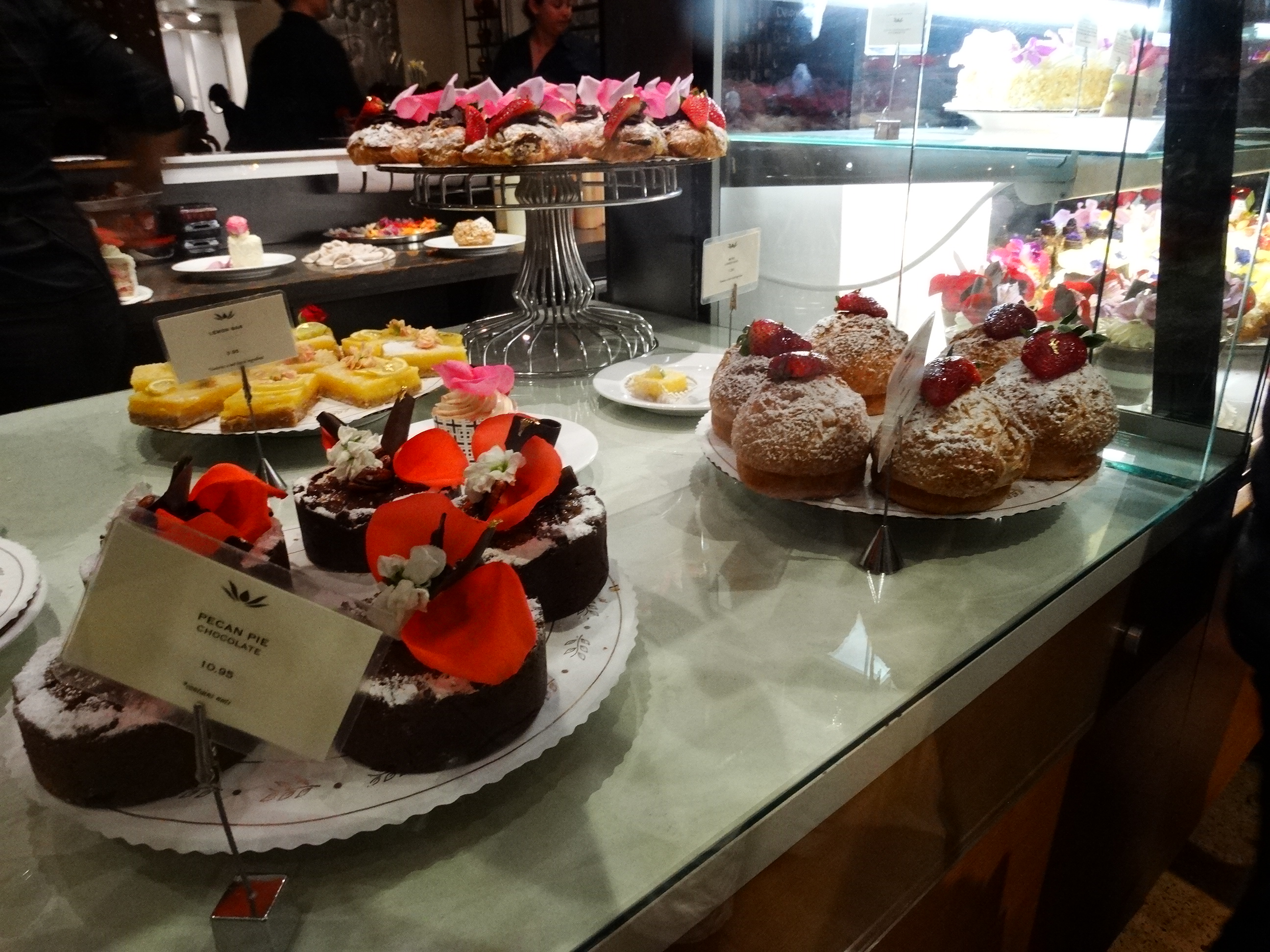
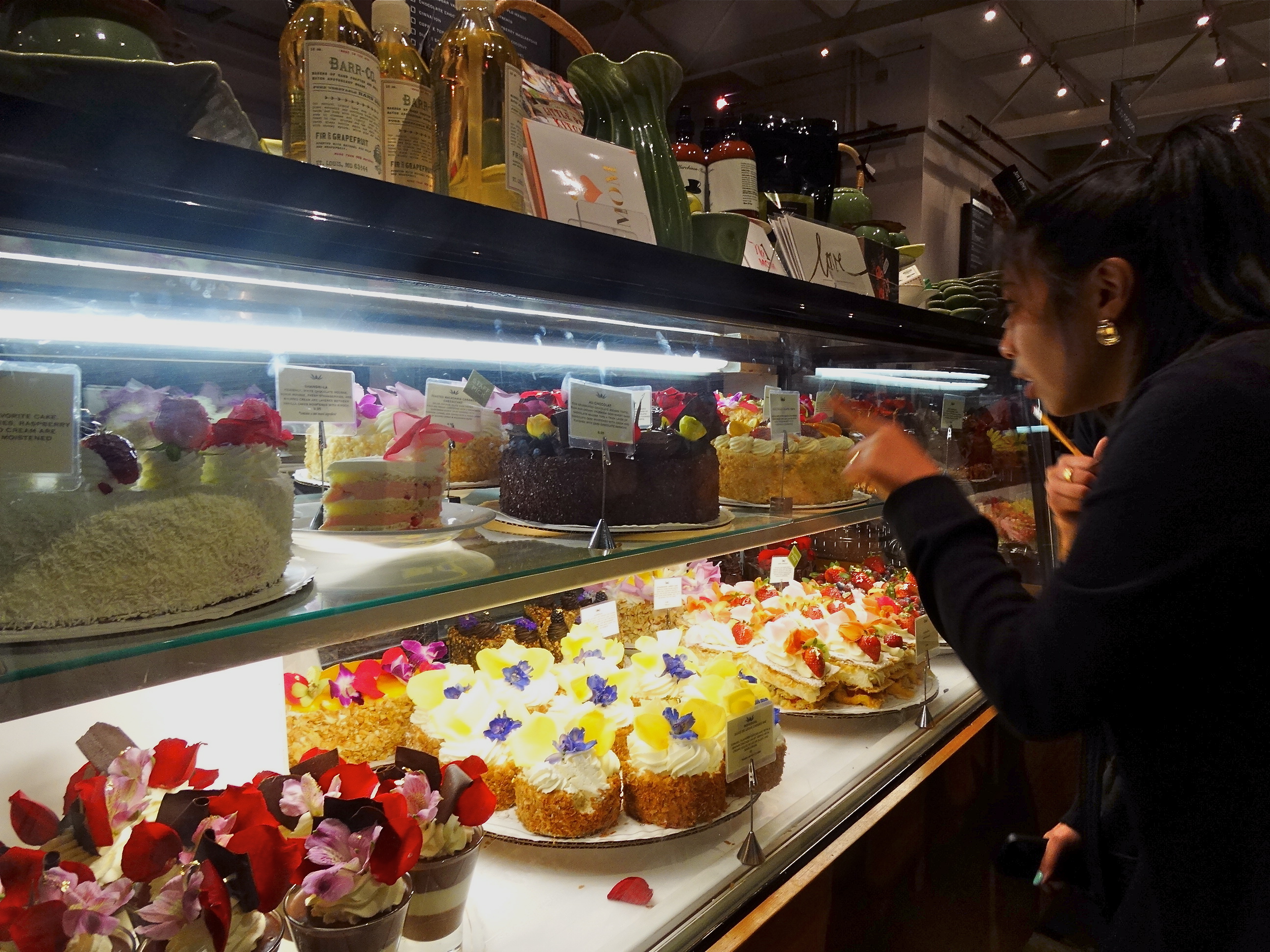
One of the goals for this journey is to find our new home. When we find a place as wonderful as San Diego, we explore the neighborhoods to try and get a sense of the place. This would be a great city to consider except that the cost of living is almost on par with the Bay Area. We are looking for someplace where the cost of living is less than the Bay Area and more low key. San Diego definitely felt less stressful than the Bay Area, especially in the Pacific Beach neighborhood but there is still the high energy city vibe going on that doesn’t fit our vision. However, it does have a pretty awesome dessert place to satisfy my sweet tooth! We had to stop at Extraordinary Desserts one more time before we left.
More desserts at Extraordinary Desserts!Decisions, decisions!
The biggest highlight of all during our stay here was seeing our good friend Renee. She recently moved to San Diego so this does add to the city’s potential as a new home. We’ll keep the area in mind but would likely try to find someplace in the surrounding area that is a little more economical. The search and the journey continues.
We spent a couple of days at Balboa Park visiting the museums, looking through the artists’ studios and enjoying the people watching. The park was a beautiful backdrop for weddings. These couples looked so happy in their moment and the variety of ceremonial styles reflects the wonderful and varied ethnic make-up of San Diego.
There were so many museums that we didn’t have time to see them all. We chose the Museum of Photographic Arts (MOPA) and the Museum of Natural History. The photography museum had an exhibit of the Prix Pictet prize winners of the year’s theme of “Power”. Each year, an important social or environment theme is chosen. These were photos demonstrating the artist’s interpretation of Power and its societal and environmental impact. There were 12 shortlist artists whose work was on display. These ranged from photos of the Chernobyl nuclear waste zones by Rena Effendi, BP’s Deepwater Horizon oil spill by Daniel Beltrá, and incredible photos of the raw emotions on display by our world leaders at the 11th United Nations Conference on World Climate Change by Joel Sternfeld. This was photo journalism that reminded me of Life Magazine and what I miss in today’s journalism. Creating an image that really makes the viewer think is so undervalued today and it was refreshing to spend the time admiring this artform. Unfortunately, I couldn’t take photos in the museum for obvious reasons but I encourage you to take at look at their work here http://www.prixpictet.com/portfolios/power-shortlist/.
We saw an exhibit on Real Pirates at the Museum of Natural History that we really enjoyed. The booty from the slave ship Whydah, a sunken pirate ship, was on display along with the narrative of the ship’s captain “Black Sam” Bellamy. The ship sunk in 1717 off the coast of Cape Cod and wasn’t discovered until 1984 by Barry Clifford. We have all heard of pirates but I really had no sense of the number of pirates (around 2000 at the height in 1720’s) that were terrorizing the high seas and coastlines of the Americas during the 1700’s. The possibility of making a small fortune as the crew of a pirate ship was the lure for many young men, and a few women. These pirate crews would share equally with their mates if they landed a ship.
There were no photographs allowed in this tour but here is a photo of the museum being attacked by a pirate!
The rest of the Museum of Natural History had the expected displays of fossils and information on our earth’s history. I love going to museums to learn about the natural history of the area I’m visiting and the San Diego museum had much of its focus on Southern California and the peninsula of Baja California both on land and sea.
MastodonMouth of a finback whale.
There was a special exhibit on California’s water history. I love seeing the creative ways that information is displayed. Museums have the special challenge of trying to be informative and engaging in designing their exhibits. I loved this particular display showing how the water of the Colorado River is siphoned off to various cities and states along its route. The most startling fact that I learned in this exhibit is that only 2% of our earth’s water is fresh water that would be suitable for human consumption in all of its forms for drinking, watering our lawns, gardens & crops or for our livestock.
There is a beautiful botanical garden in Balboa Park which had beautiful displays of orchids.
This orchid looks fierce!
We spent quite a bit of time just walking through Balboa Park, enjoying the scene and doing a lot of people watching. We also spent a little time going through the artist studios and speaking with the various artists about their passions. There were potters, painters, sculptors, jewelers, glass blowers and perhaps others that we missed.
At the water’s edge near the botanical garden.Mallard close-upStreet scene in Balboa ParkBalboa Park from the artist’s perspective.
I underestimated the amount of time that we would want to spend touring the USS Midway. The ship is massive and there is so much to see and learn during the tour that it would take a full day to cover everything. We completely ran out of time so missed the presentations about the control tower, the launching of the planes and the landing of the planes.
The number of volunteers that are on the ship assisting with the tours and basically making the whole USS Midway accessible to the public is amazing. They are also responsible for much of the work that went into cleaning the ship like removing the rust from the anchor chains (each chain weighs 156 lbs) and twenty-ton anchors on display. There were veterans at various audio tour spots who would who would answer questions or provide their own short presentation relevant to the particular section of the ship. We were fortunate to hear a veteran’s experience as an intelligence officer during WWII. The whole experience just added to the respect I feel for all of our military personnel who serve our country. This is definitely not a pleasure cruise.
The flight deck is 1,001 feet long and 4.02 acres.
They’re living in quarters that I doubt the average person would consider living in for any length of time and working jobs that would be demanding under normal conditions on land but they might be out at sea under the stress of war. It’s beyond my imagination to truly appreciate what they do. Imagine coming back to these bunks after a long day!
The displays were impressively designed to give the tourist a sense of what life was life on the ship with life size figures dressed in uniform performing their duties as if frozen in time.
View from flight deck. Do you recognize anyone here?
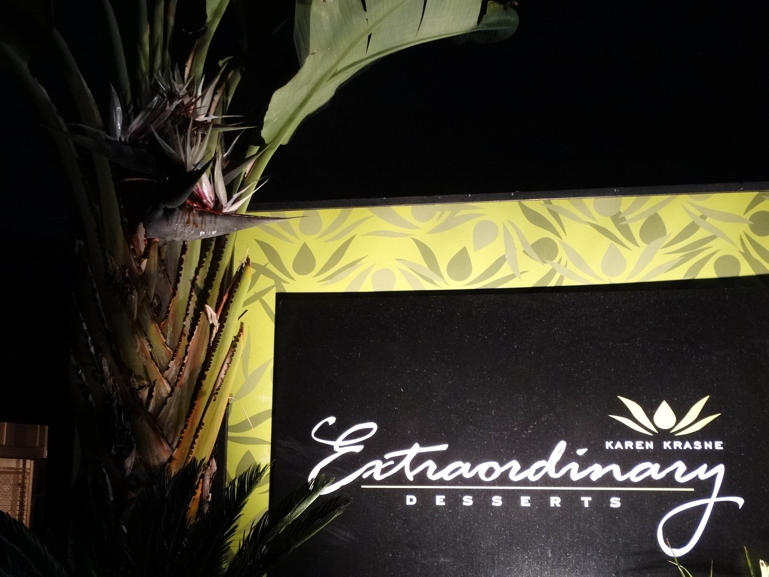
After our tour we had dinner at Ra Sushi in the Gaslight District. The food was quite good but what I was really looking forward to was dessert! Darryl found this amazing dessert place which was the second highlight of our day! Karen Krasne’s Extraordinary Dessertshas a mind boggling number of desserts to choose from and they all look delicious which makes it even harder to choose just one. During our stay in San Diego, we tried both of their locations because it was that good! They have a smaller restaurant in Balboa Park neighborhood which features desserts, cakes and teas and a larger restaurant in the Little Italy neighborhood near downtown San Diego. Karen studied at France’s Cordon Bleu culinary school and although she is recognized as a celebrated pastry chef, she frequently returns to France to train with other masters and finds inspiration through her travels.
We started our trip at a little past midnight on Saturday, March 8 heading toward Death Valley from our home in San Jose, CA. The distance is just over 400 miles which we broke up into two stops. The first was at a Holiday Inn Express in Fresno, CA and the second at Ricardo Campground in Red Rock Canyon State Park just outside Mojave, CA.
This was our first camp site.Darryl washing dishes after breakfast.Our home for the next 6 months.
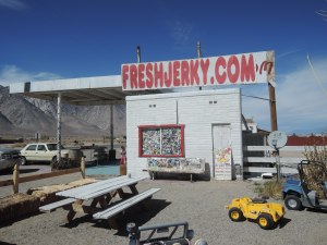
On 395 near Olancha, CA we stopped to check out the Freshjerkey.com. Neither of us eat much jerkey but this was really good! Nice and tender with great seasoning. Their dried apricots were so good that Darryl had to return after getting gas to buy another bag. We were thinking that we found this unique little place until we saw another one a few days later outside of Beatty, NV. In any case, we highly recommend the jerkey and the dried fruit so check them out on line at Freshjerkey.com and they will ship their goodies your way.
Dropping down into Death Valley we stopped at a vista point off of 190. The views were spectacular but impossible for me to capture adequately on film.
We stayed at Panamint Springs Resort in Death Valley. I met a fellow Iowan working at the General Store. She and her boyfriend were following seasonal work throughout the National Parks. They just came from Glacier National Park. Pretty cool way to spend your first years out of school in my opinion!
Enjoying the trip!
The next day we went to Ubehebe Crater. We thought that it was a crater created by a meteor but learned that it’s actually the result of a volcanic eruption and there are many of these craters scattered throughout the park.
We hiked down to the bottom of the crater which was a pretty steep descent. You can see Darryl off in the distance.From inside the crater
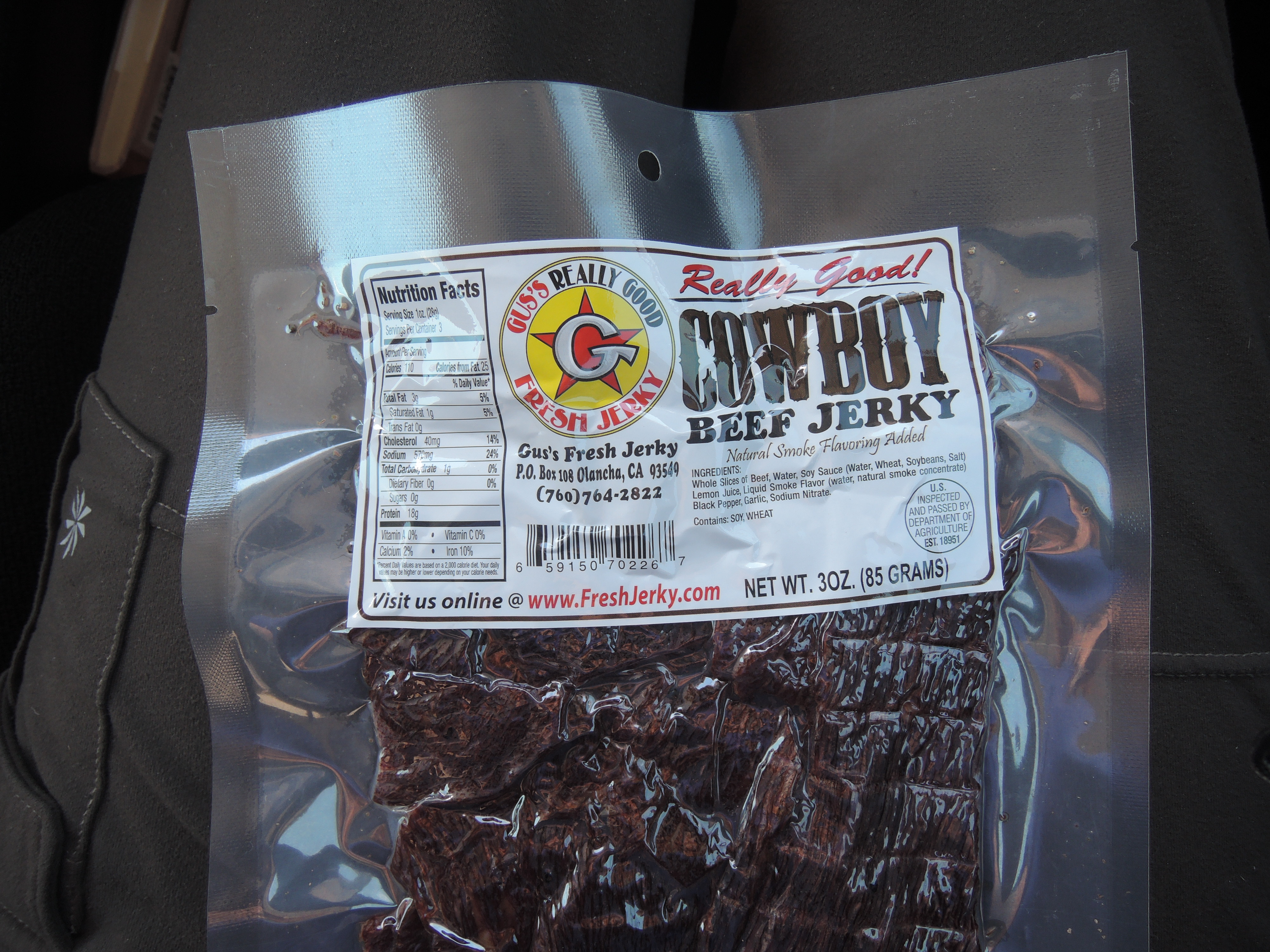
We had hoped to drive through Titus Canyon on this trip through Death Valley but learned that it was closed due to some washouts that were being repaired but might reopen any day. In the meantime, we decided to do a side trip over to Las Vegas to pick up some car parts at the Toyota dealer. Along the way, we stopped at Rhyolite, a ghost town just West of Beatty, NV. There were still a number of buildings visible.
I took a photo of the self-guided walking tour document to show just how short-lived these gold rush era ghost towns were. This is typical of the boom and bust cycles of other ghost towns that we’ve seen where they are bust just 2 or 3 years after their peak.
Cook Bank Building
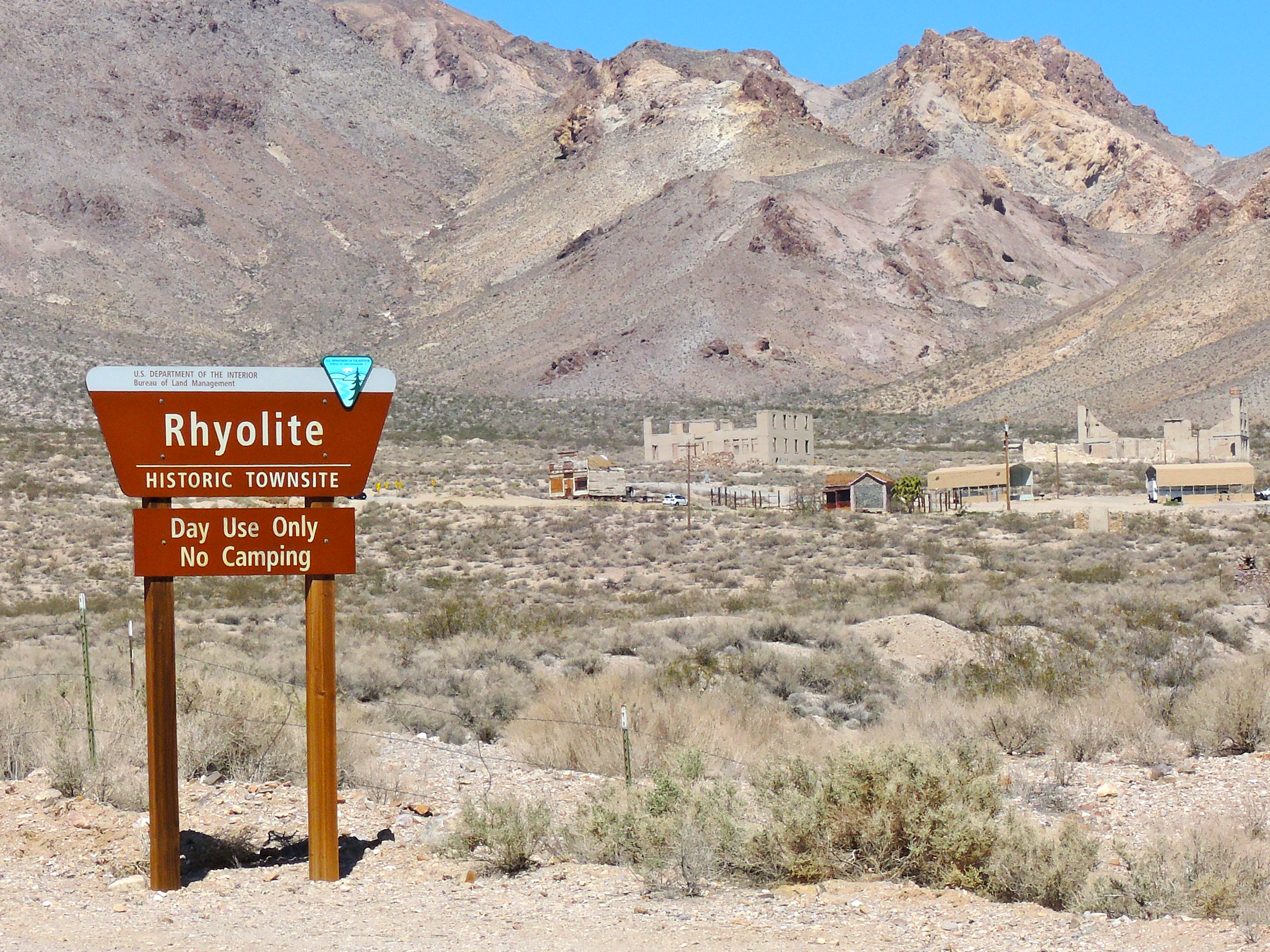
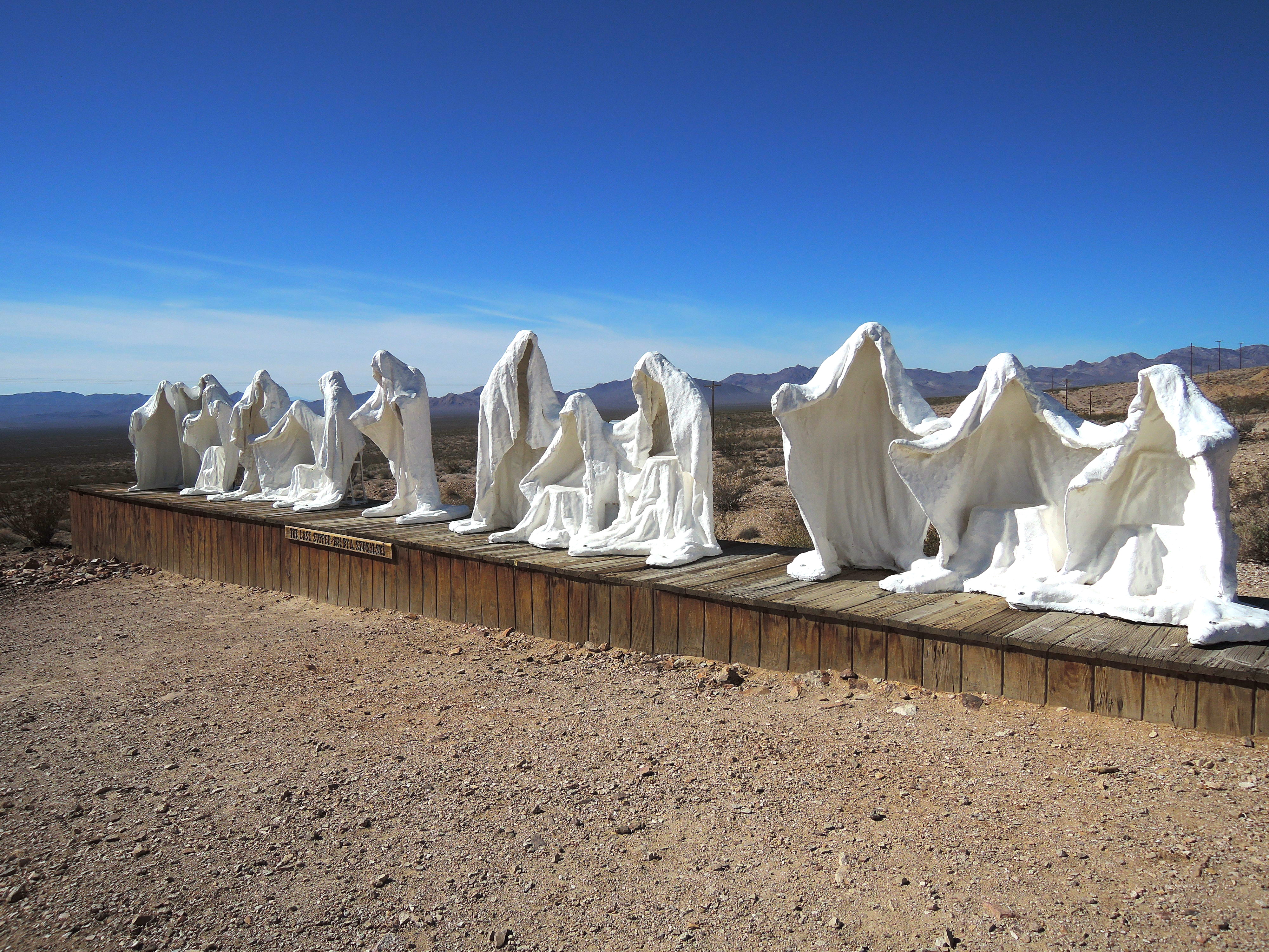
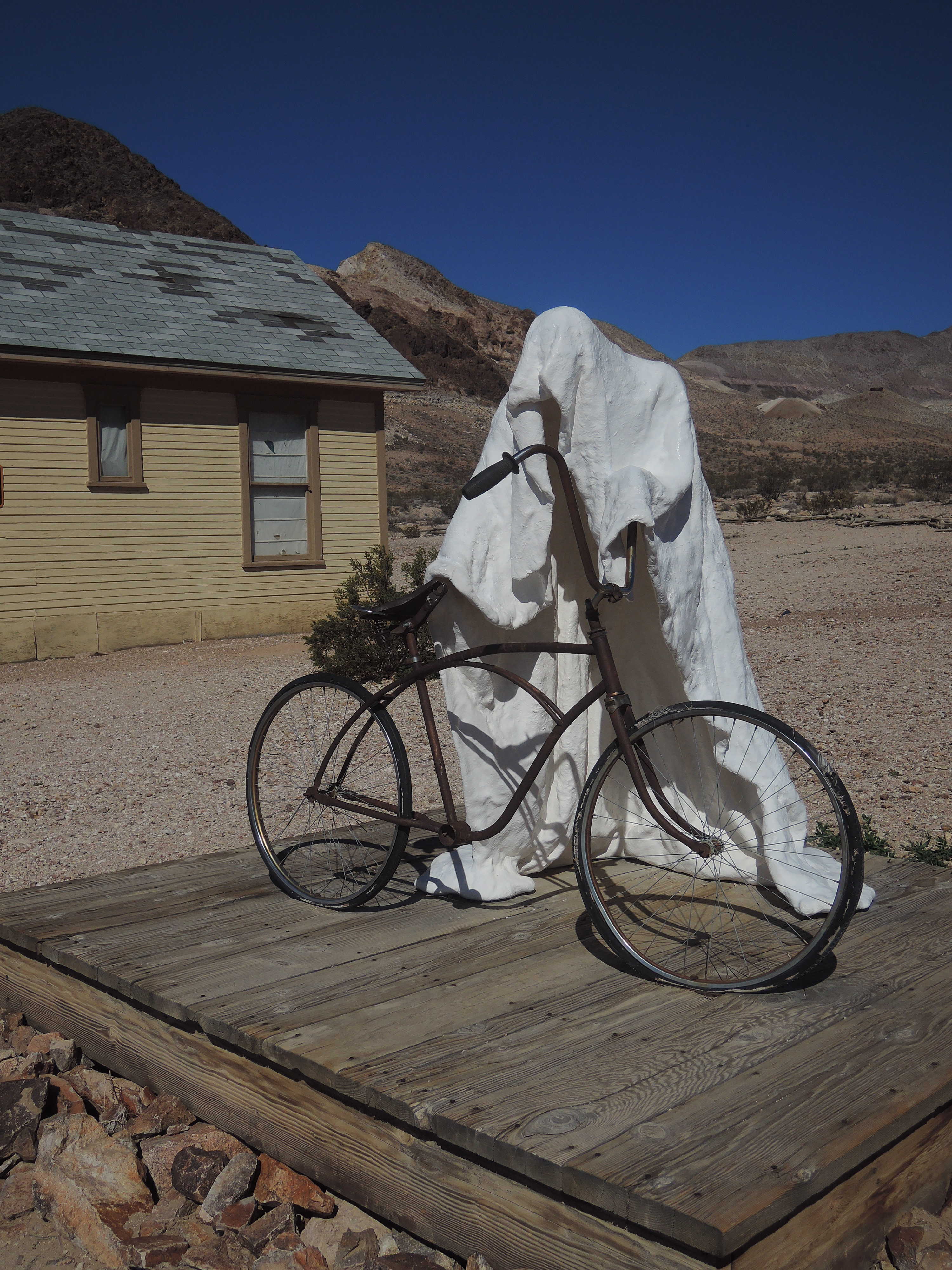
There was a quirky little outdoor art exhibit at Rhyolite led by Albert Szukalski which led to the founding of the Goldwell Open Air Museum.
An interpretation of The Last Supper by Albert Szukalski.Ghost rider
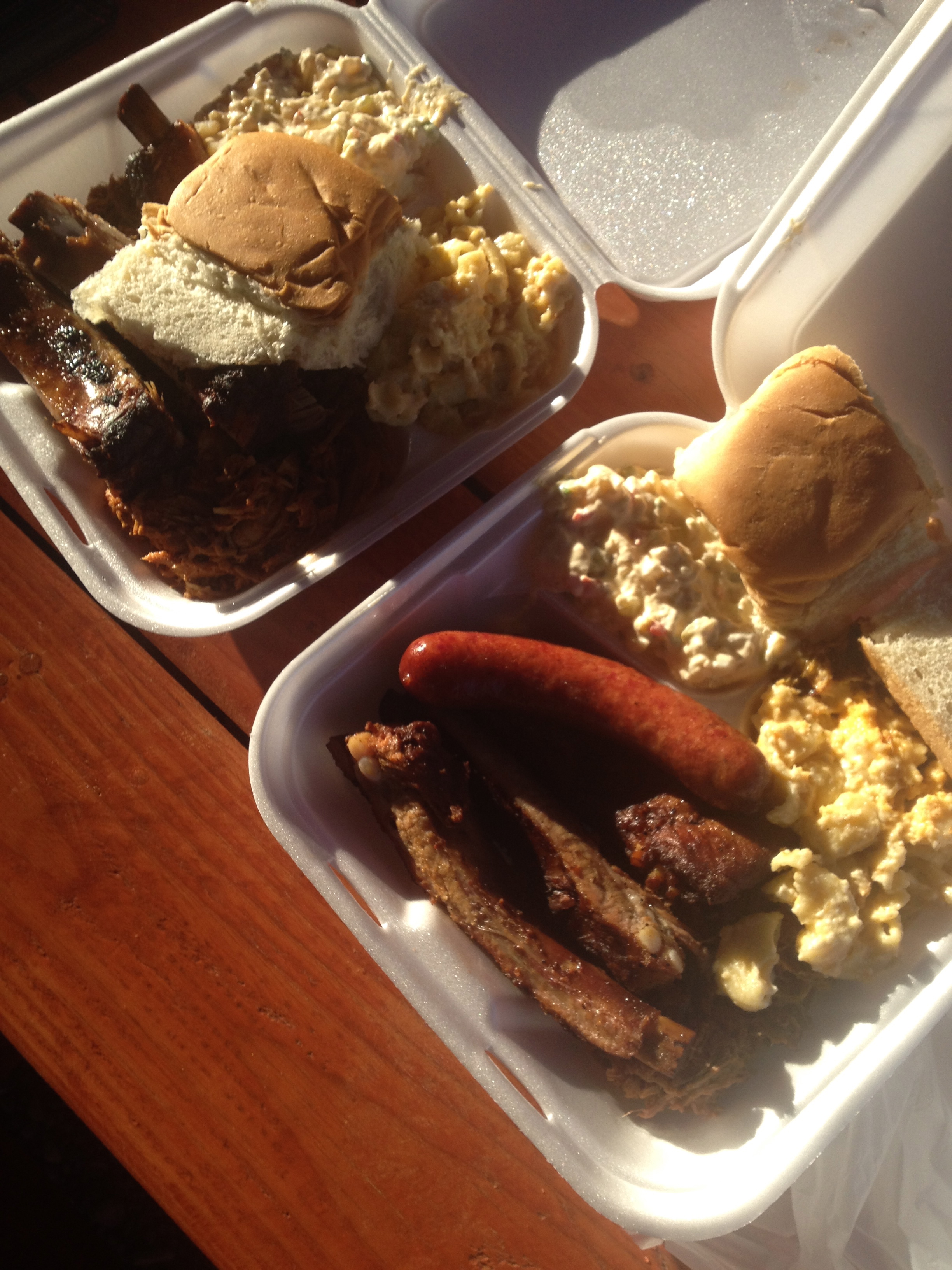
After Rhyolite we headed over to Las Vegas and had the best BBQ yet at Road Kill Grill! This was a real find thanks to Guy Fieri of Diners, Drive-Ins and Dives. When we don’t have time to get a local’s recommendation, we have had great luck at checking out the spots that he has reviewed http://www.flavortownusa.com/.
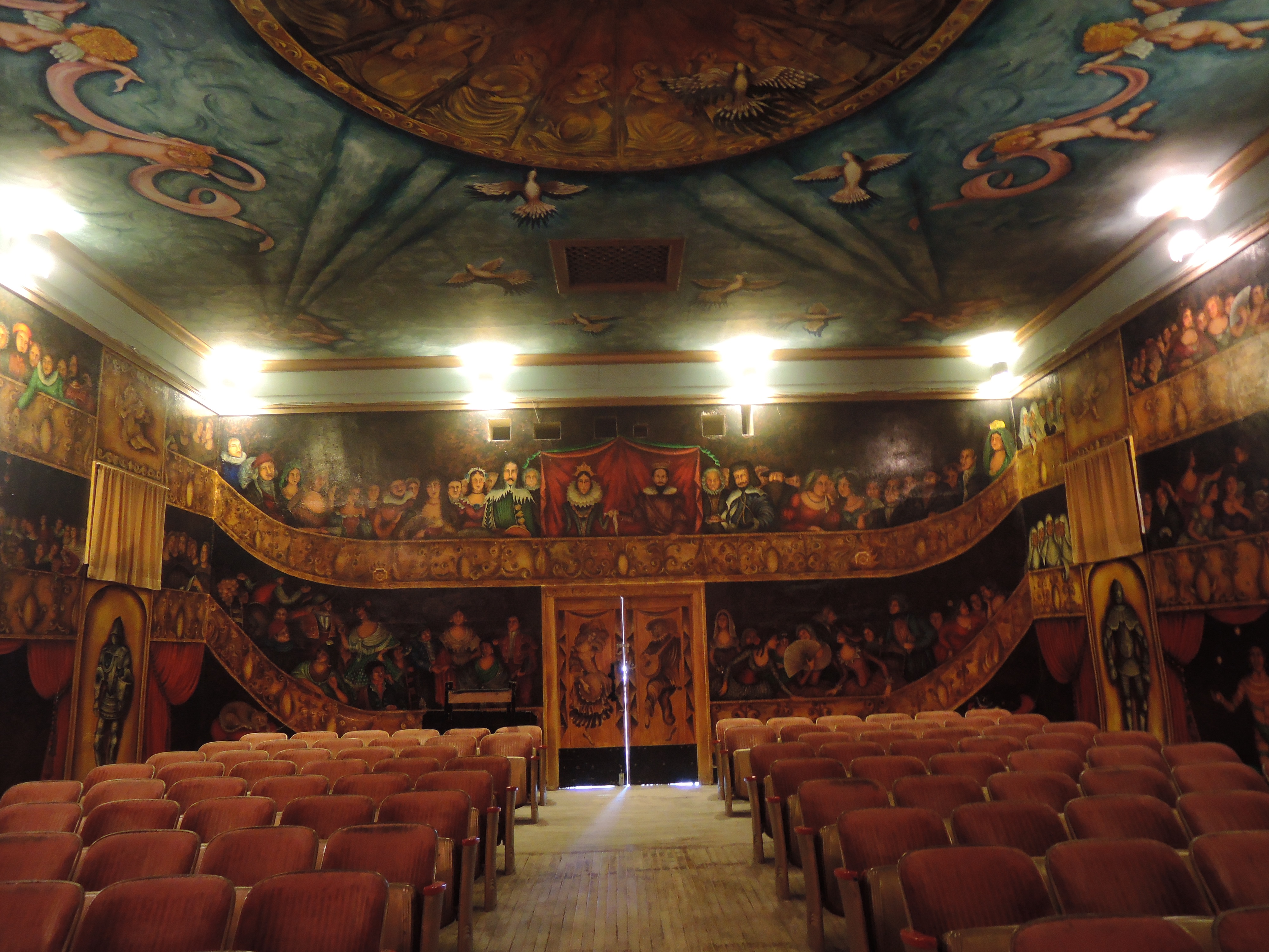
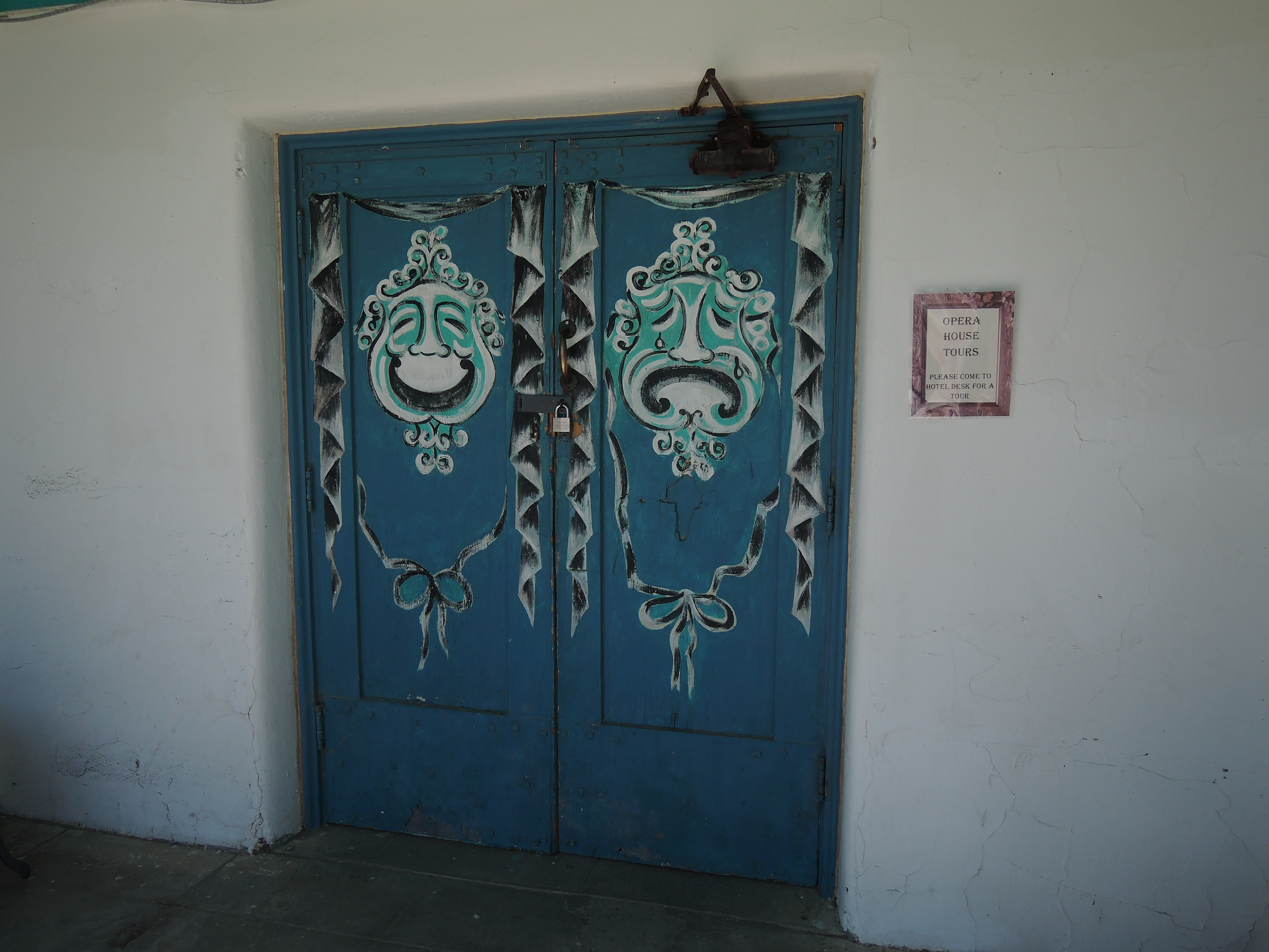
Our next stop was to learn about ghosts at the Amargosa Opera House. Someone we met from Pahrump, NV told us about the place and how it was featured on a ghost hunters program. We thought that it would be fun to stop by and take the tour. We Didn’t learn about any ghosts but instead were treated to the fascinating life story of Marta Becket. She is 90 years old and owns the tiny town with a population of 2. She passed through Amargosa in the late 60’s and returned for good in the early 70’s leaving New York with her husband to create a new life in the West. She held weekly performances in the Opera House but rarely had an audience to the remote location. Marta decided that if she didn’t have a live audience then she would create her own and painted the murals the decorate all of the walls and ceiling of the Opera House.
After the tour, we walked over to the little cafe in the hotel and had the BEST cherry pie EVER! Unfortunately, I didn’t get a photo quick enough. If you ever drive through Amargosa, this is well worth the time to rest and have a wonderful little treat.
Our next stop was Dantes View in Death Valley. This viewpoint looks over Badwater in Death Valley. Again, the views are dramatic but I haven’t figured out how to do them justice in my photos.
On our way back from Dantes View we took the dirt road through 20 Mule Team Canyon. This was our first “off road” trek which was extremely tame. Just the sort of baby steps I needed to get comfortable with the idea of “off-roading”. 🙂 There was really no need for a 4×4 and the views were stunning. It is definitely worth of a short side trip given the scenery.
That evening we camped in the back country along Hole in the Wall road. This was our first free campsite in Death Valley since we didn’t realize that you can actually dry camp in the back country as long as you’re 2 miles off any main road. There is a brochure that you can get at Furnace Creek if you ask the ranger. It’s not something that is publicized and we couldn’t find any information about backcountry camping on the National Park Service’s website.
Our first free campsite and my first attempt at using the tri-pod and timer.
We drove to the end of “Hole in the Wall” road after breakfast and found more beautiful views and interesting rock formations but we couldn’t find the hole.
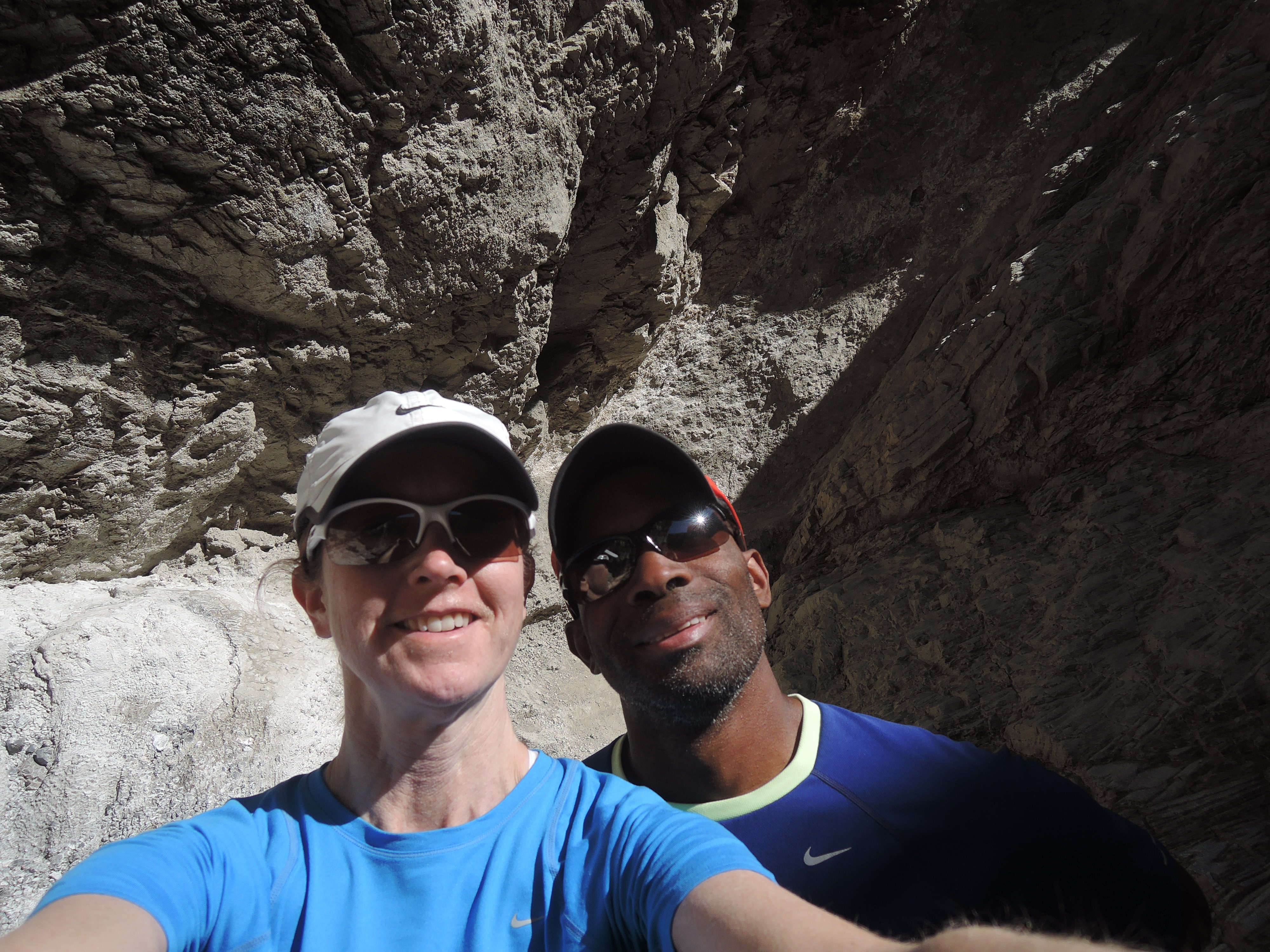
Since Titus Canyon was still closed we decided to venture back toward Stovepipe Wells and do the short hike at Mosaic Canyon. The hike was nice and cool since it was through a tight canyon with cool marble-like rock surrounding us. Here we are at the end of the canyon.
After the hike we made the trek toward our next campsite at Wildrose. This was also free but was a maintained site with vault toilets and fire pits. As we watched gained in elevation, we knew that we would be in for another cold and windy night! We learned that March is the windiest time to visit Death Valley and the nights got down to the high 30’s but the days were perfect just hovering in the low-mid 70’s. The campsite as at 4,144 feet but FREE! On the way, Darryl had me get out and take a few shots of a “bad ass” vehicle we saw along the way. There will be a separate home for his killer vehicles that we’re collecting along our trip.
The next day we drove down to the Swiss engineered charcoal kilns built by Chinese laborers in 1879.These were built to make charcoal, a process that would take up to two weeks. This charcoal was used for the silver and lead mining operations at Modock Mine in Death Valley. The kilns closed after only 3 years of operation.
After our venture out to the charcoal kilns, we headed back to Furnace Creek, a distance of over 70 miles, to ask again if Titus Canyon was open. Unfortunately, it was still closed with two more sections to fix. It wouldn’t be open anytime soon so we decided to move forward with our trip and leave Titus Canyon for another day.
We stopped in Baker, CA for gas and a quick bite to eat to figure out our next place to spend the night. We decided on Hole in the Wall campground in Mojave National Preserve. A little trivia for you here; the difference between a National Preserve and a National Park is that you can hunt in a Preserve. Fortunately, our campground was in a “Safety Zone”. We know this because there was a sign posted at the entrance. I only hope that bullets can read signs. Our campsite cost $12.
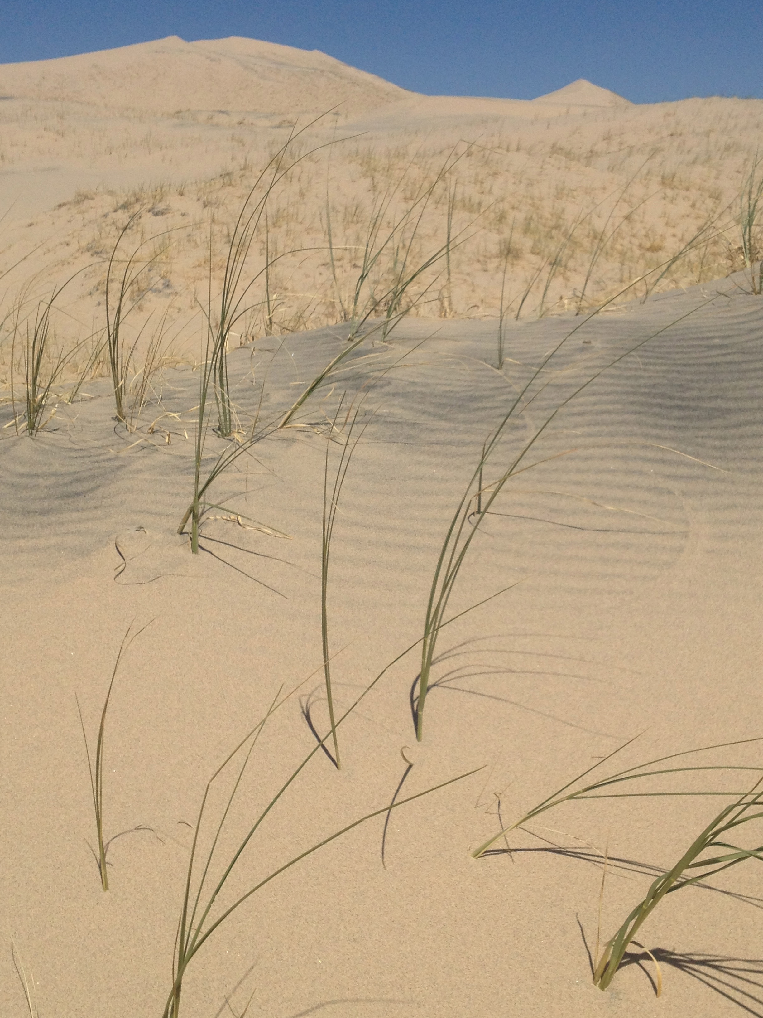
The next day we headed over to Kelso Depot and spent some time looking at the “Mojave Moonlight” photo exhibit by Tom Lowe. They were pretty impressive photos of the desert at night. Our next stop was Kelso Dunes. I was enjoying the stroll through the dunes then realized that Darryl had a workout planned for us when I saw him heading straight up the side of a dune rather than taking the more gradual route along the ridge. I then learned the literal meaning of “one step forward and two steps back” on that climb!
On the way down, Darryl took the easier route.
We headed out to Barstow to find a few ghost towns to visit before heading down to Joshua Tree National Park. On the way we spent the night at Owl Canyon Campground in Rainbow Basin Natural Area (BLM land) just North of Barstow. It was here that Darryl and I first heard of the bear-dog that roamed this area 16 million years ago!
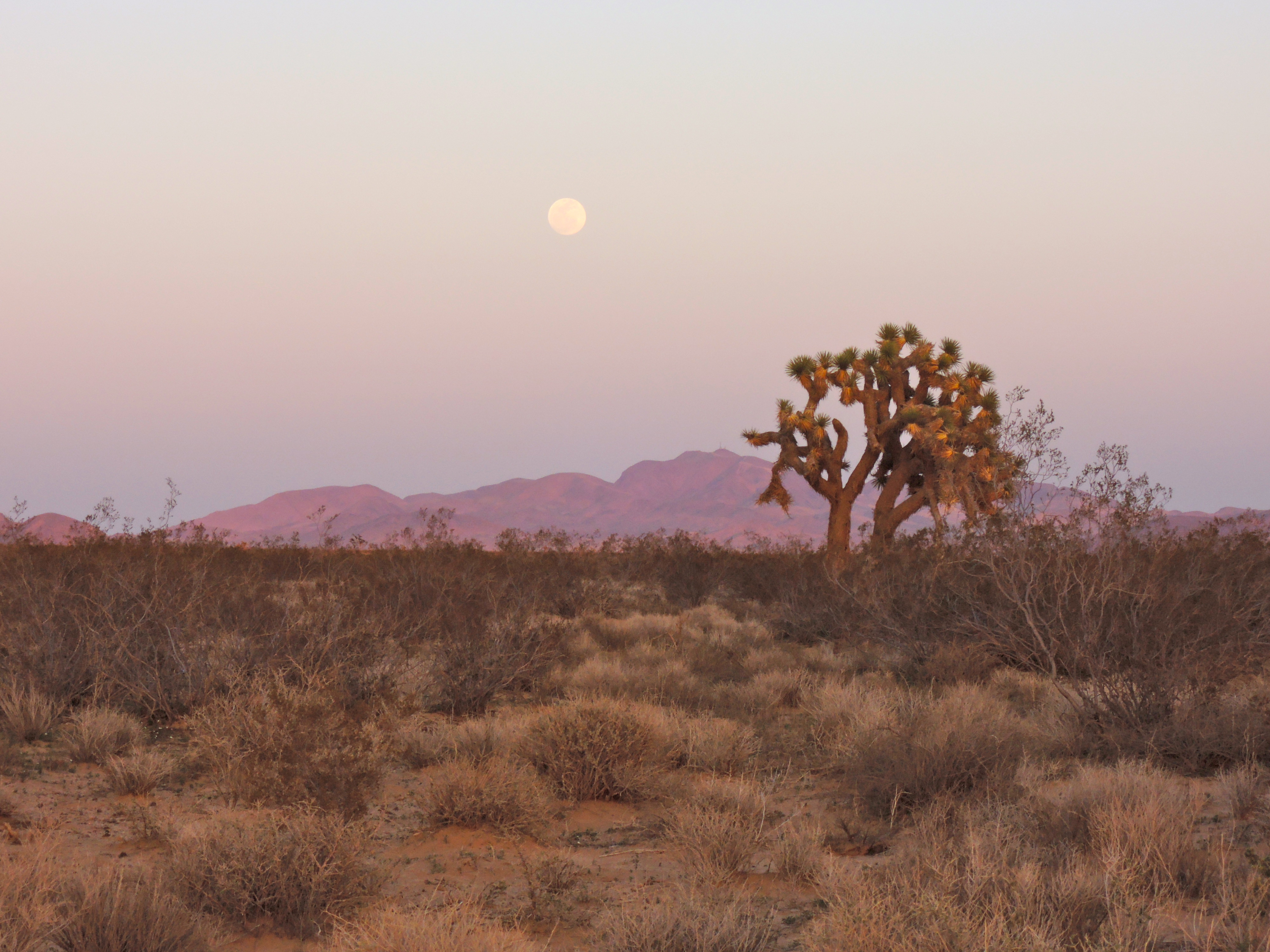
The desert sky was getting more spectacular as we drew closer to the full moon.The next day we searched for nearby ghost towns and struck out looking for the first one so we went over to Calico which was well marked on the map and by street signs.
Starbucks pre-IPO circa 1881!
It looked really interesting on the website so my expectations were running high and then they dropped a little when I saw the huge parking lot for all of the tourists and then I went into full-on disappointment when I saw the Starbucks sign. I’ve got to remember to keep my expectations in check!! But as Darryl pointed out, it was interesting to see how one of these towns looked at their peak.
Replica of original school house.Mining operation at Calico.Fire engine
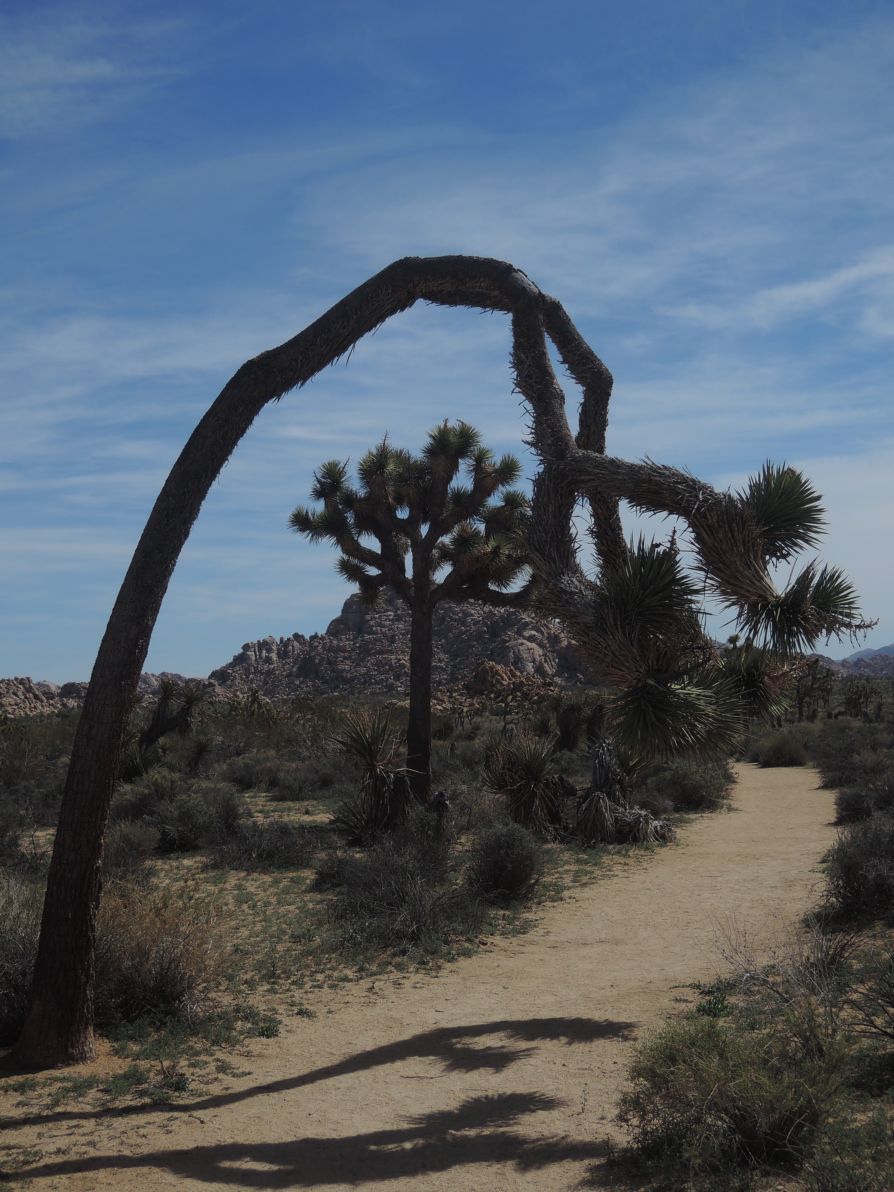
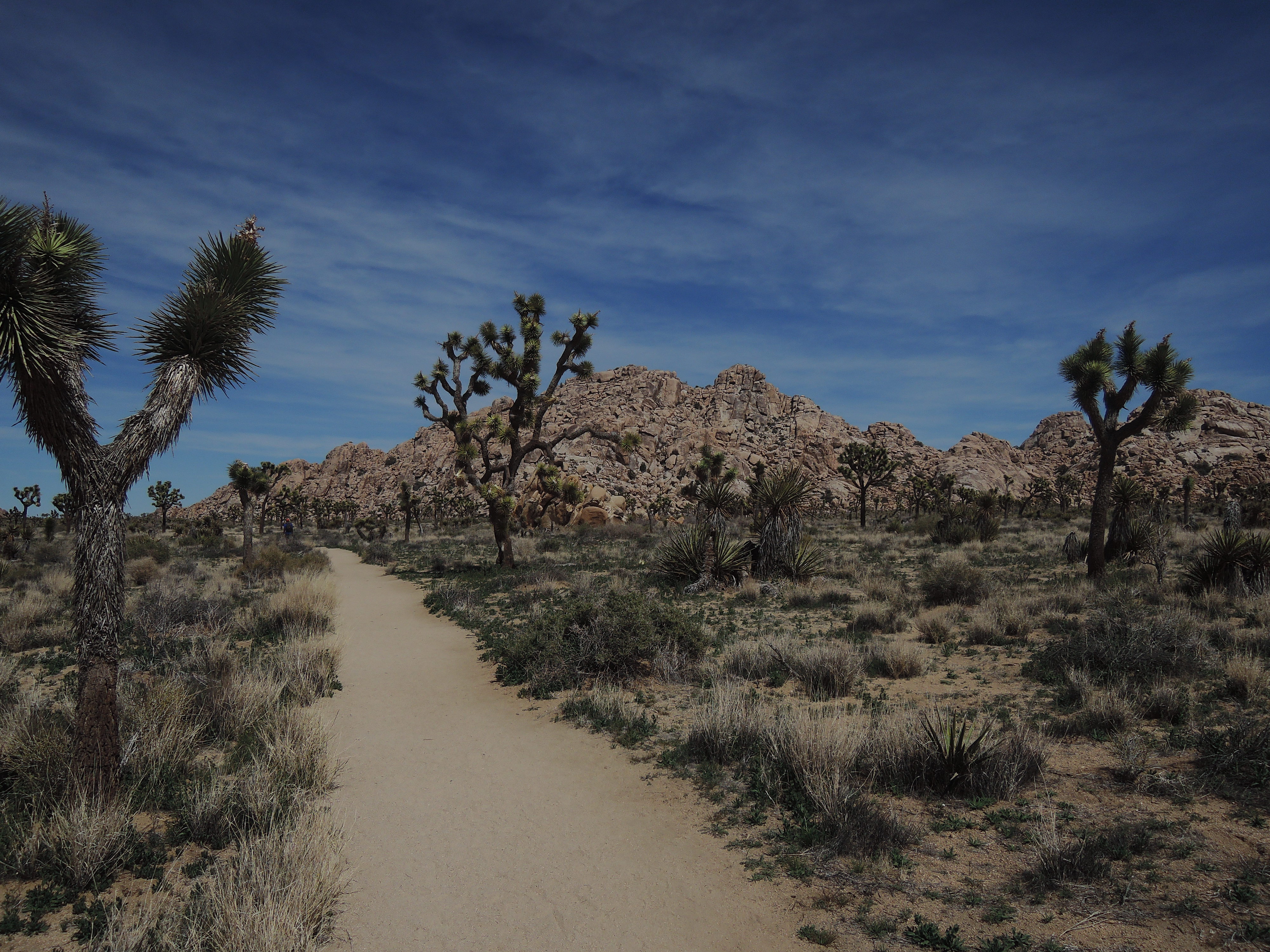
After the tourist trap we continued toward Joshua Tree National Park where we stayed at Jumbo Rocks campground. We hiked the Boy Scout Trail the next day. The drought this past winter resulted in a very limited desert bloom throughout Death Valley, Mojave and Joshua Tree. I was pretty excited to see the few blooms there were in Joshua Tree which had many more blooms compared to Death Valley.
The next day we took the Geology Road and saw a little more of the back country. The road was actually a self-guided geology tour along an 18 mile dirt road. They did a really good job of identifying various geological points of interest along the road. If you make it to Joshua Tree, spend the hour to take the tour. Unfortunately, my photos didn’t make the cut for this post.
We then headed out of Joshua Tree the park and into Joshua Tree the town for a few hours of cleaning. First, Darryl found this amazing shower at Coyote Corner where you could get 7 minutes of water for $4. Well worth it after a few too many days without one.
Then we went to get our landry done. While it was drying, we went to the Natural Sisters Cafe for something sweet and we were not disappointed. We shared a vegan apple muffin (delicious!!) and we each had a smoothie. Mine was the Climbers Revenge made with dates and Darryl’s was the Desert Sunrise. They were both awesome! We highly recommend their deserts and smoothies. We didn’t try the sandwiches but they get great reviews on Yelp.
Our next stop was Palm Springs, CA where we had amazing burgers at Woody’s Burgers. We did errands in the Palm Springs area and then back to the fun stuff.
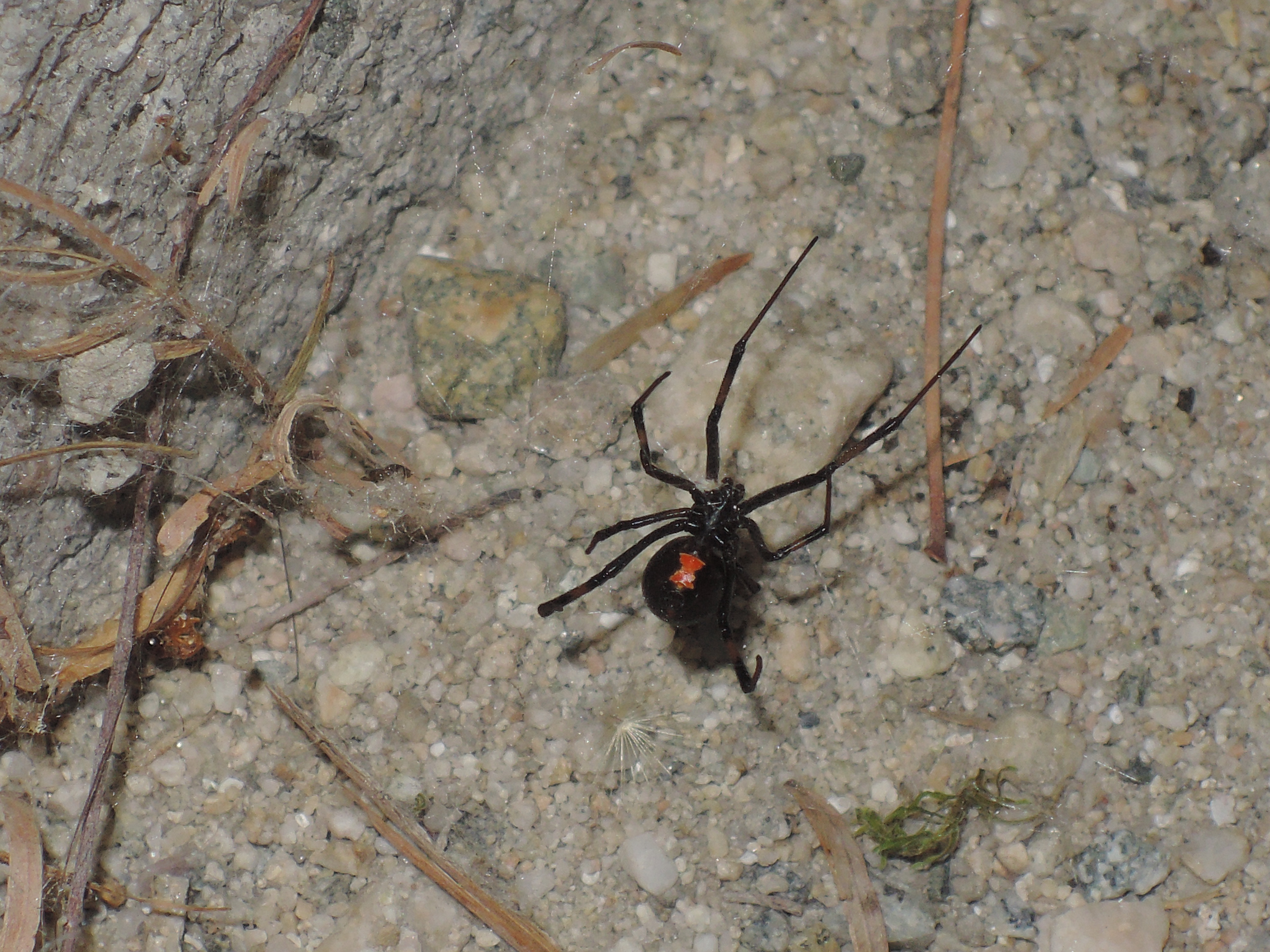
We continued on to the Salton Sea. Here is a photo of our guest at the campsite there, a beautiful little black widow. We wandered along the coast of the sea which had the most interesting beach made of what looked like fish cartilage. The place smelled like dead fish given the many fish die-offs resulting from the over population of Tilapia which is estimated to be over 400 million.
Our final stop along the Salton Sea and before dropping into Baja Mexico was to see Slab City which I saw in the movie “Into the Wild”. I was curious to see how similar it was to the movie, it wasn’t. Hollywood sure can create fiction from reality.
Next stop border crossing at Mexicali and then on to Baja California, Mexico!!