Category Archives: Baja California

Northbound in Baja

We crossed the border into Mexico on March 21 and on April 15, we awoke in La Paz on our northbound journey through Baja. We wanted to get back to the states within the next week so we could spend some time visiting our Zion, Bryce, Canyonlands, Moab and surrounding areas before the heat of summer made it unbearable. We will cover the distance between La Paz and the border in half the time that we took when we drove south.

We awoke pretty early in La Paz thinking that we would get on the road to Loreto at a decent hour. Instead, we spent a few hours chatting with an interesting character who is trying to completely move out of the US and settle down in Baja. For many reasons, he has decided that the American lifestyle and its geopolitical standing is not for him and he would rather associate himself as a citizen of the world. Since that doesn’t exist, he’ll opt for becoming a Mexican citizen, renouncing his US citizenship.

We finally said good-bye to our neighbor, packed and we were ready to go.

Photographer's home
Photographer’s home

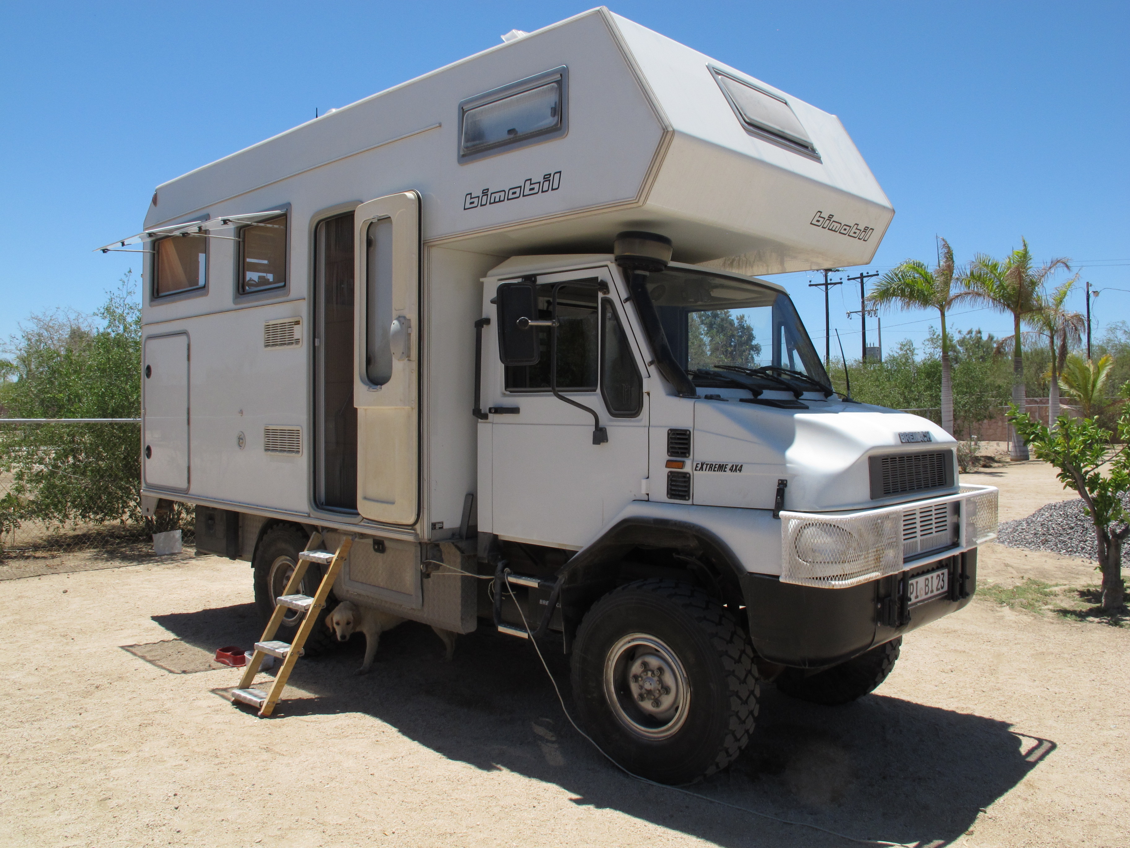
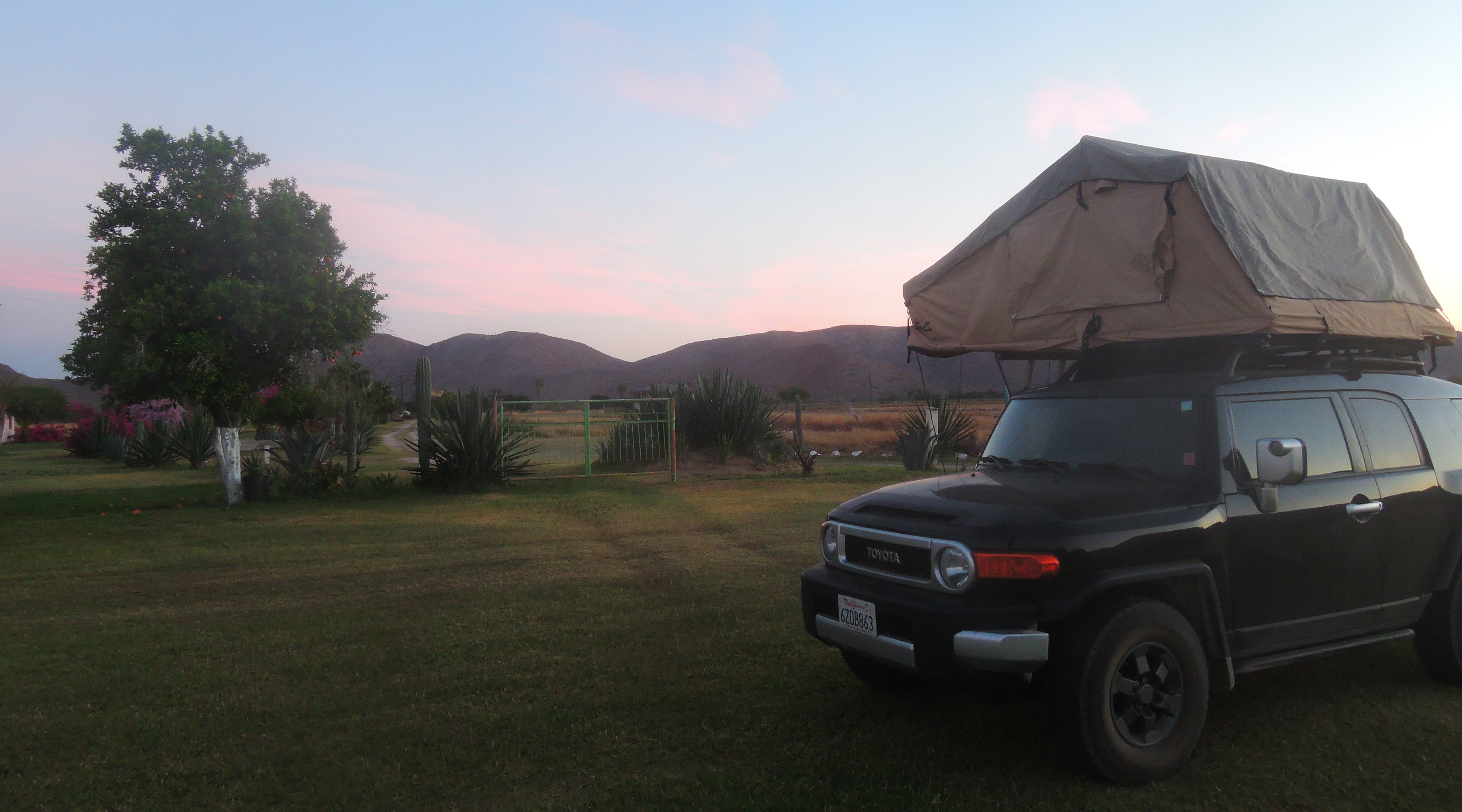
Darryl wanted to get one quick photo of the seriously cool vehicle on the campgrounds. I stayed behind to continue catching up on my journal and after about an hour, I realized that Darryl was probably getting a grand tour of the vehicle and collecting another life story. I was right, he was. The owner of the vehicle was a Dutch photographer who sold everything that he had, leaving his home with just two suitcases, setting out on the road to travel the world in his vehicle. He decided that a life full of things and a physical place  that had to be maintained prevented him from really experiencing life so he sold it all and lives a much simpler existence. It took him awhile to adjust but now he feels more at peace than ever.

What’s fascinating about these encounters is that they are representative of our whole trip so far. It has brought us into contact with people of all backgrounds with interesting life perspectives, giving us the opportunity to have long and involved conversations with many of them. We are learning about different lifestyles that we have never considered in our more traditional life in San Jose. We had our bubble in the US, our work, our family and our friends and once established, these are the circles of influence on a personal basis. Our circles have grown significantly these past few weeks.

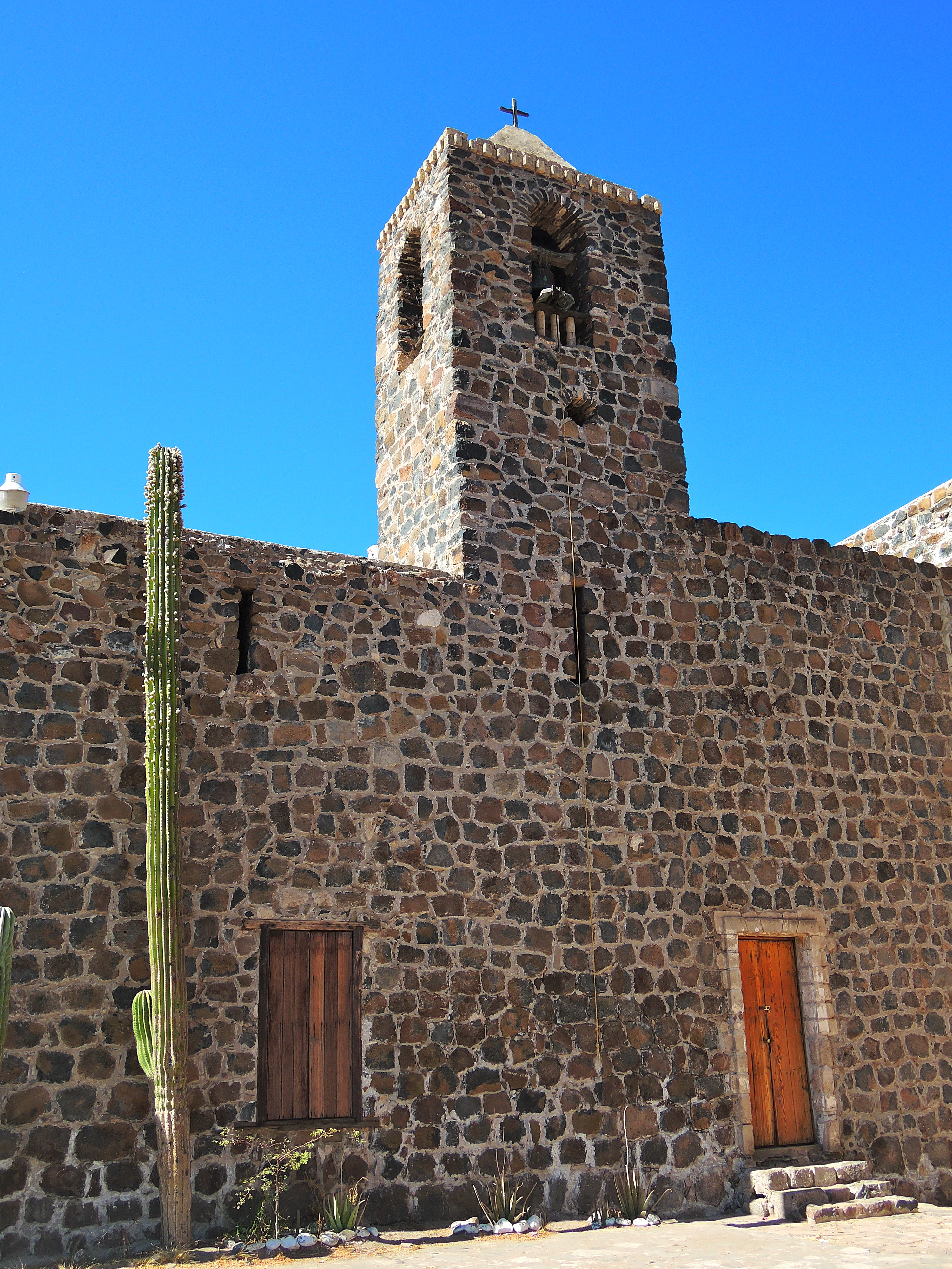
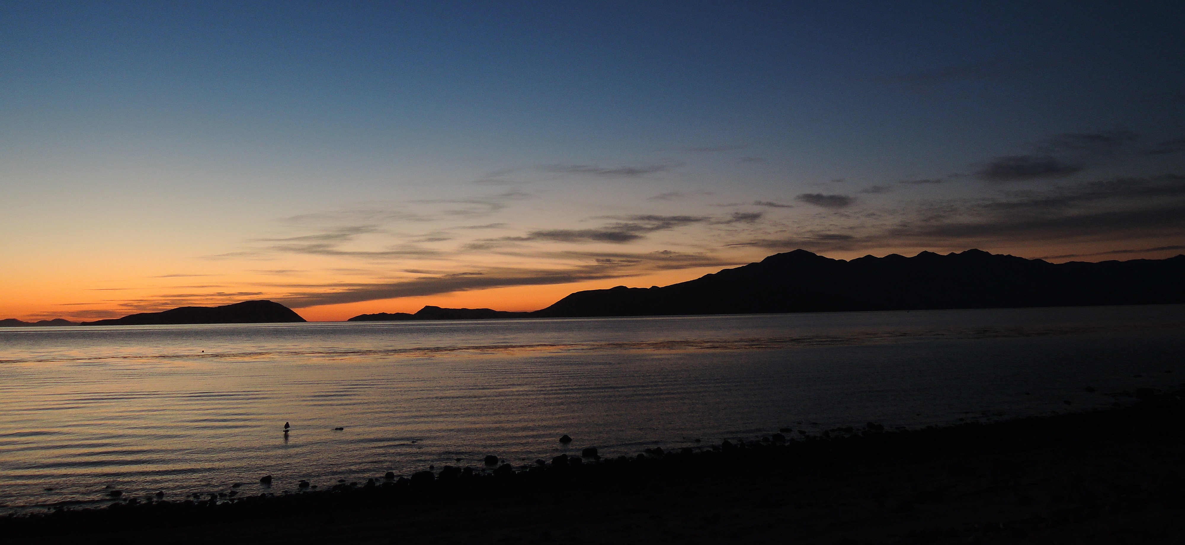
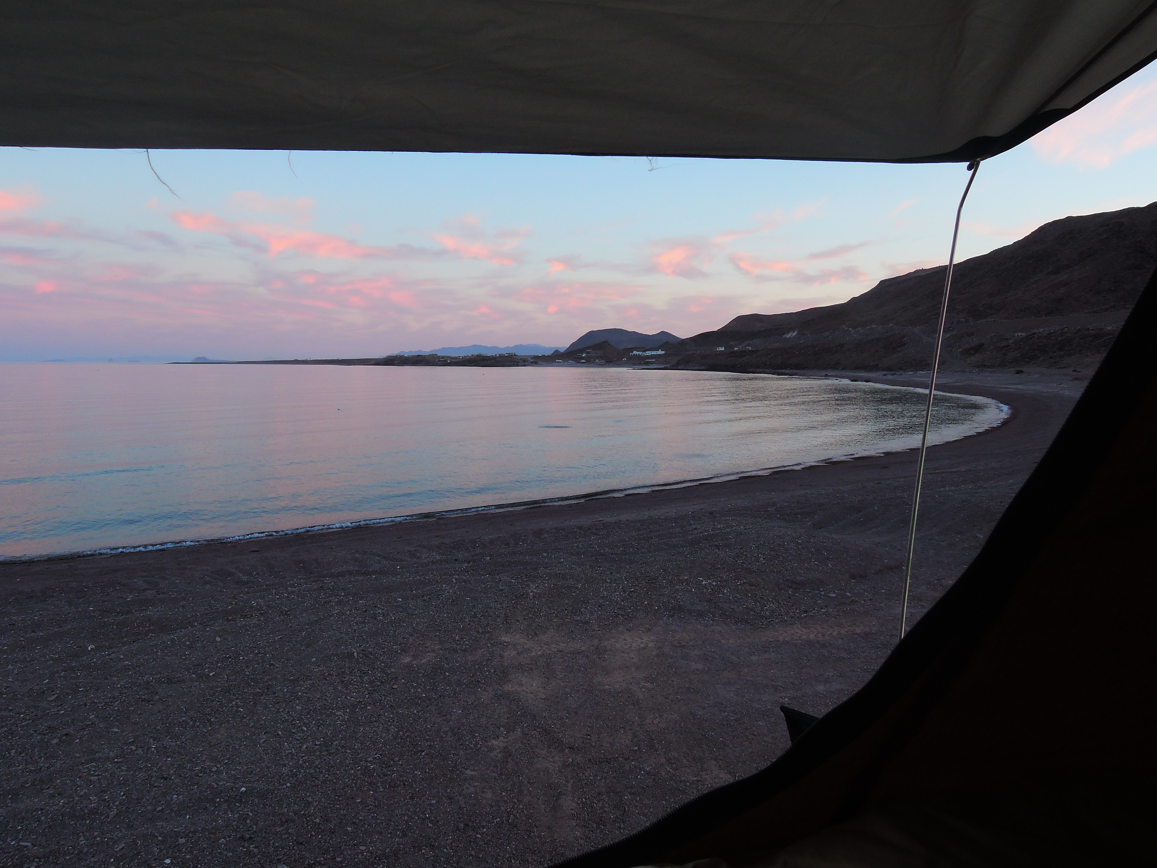
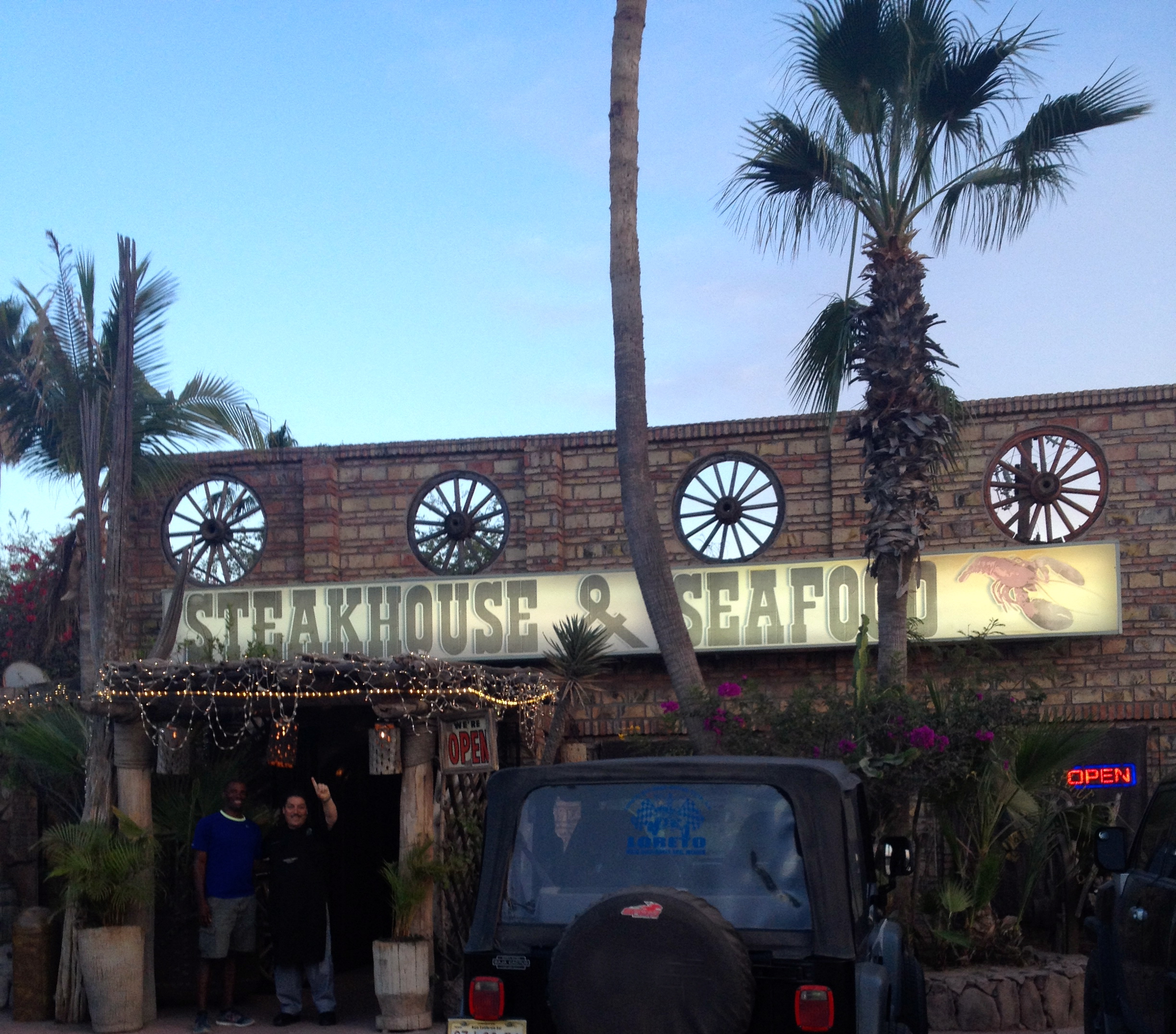
Once we got on the road, it would be a long drive to Loreto. The best part of this road is driving over the Gigante Range into Loreto at dusk was incredibly beautiful. It’s a long winding road that provides these spectacular views of the valley and then passed the summit, the waters of the Gulf of California and Isla Carmen are spread out across the horizon. It was absolutely stunning. We ate that evening at this Steakhouse which is on the outskirts of town which was recommended to us by Greg who we met earlier in the trip at Santa Rosalia. After dinner, we returned to the Riviera del Mar RV campgrounds where we stayed earlier in the trip.

Thanks for the recommendation Greg, Jen & Arnold!

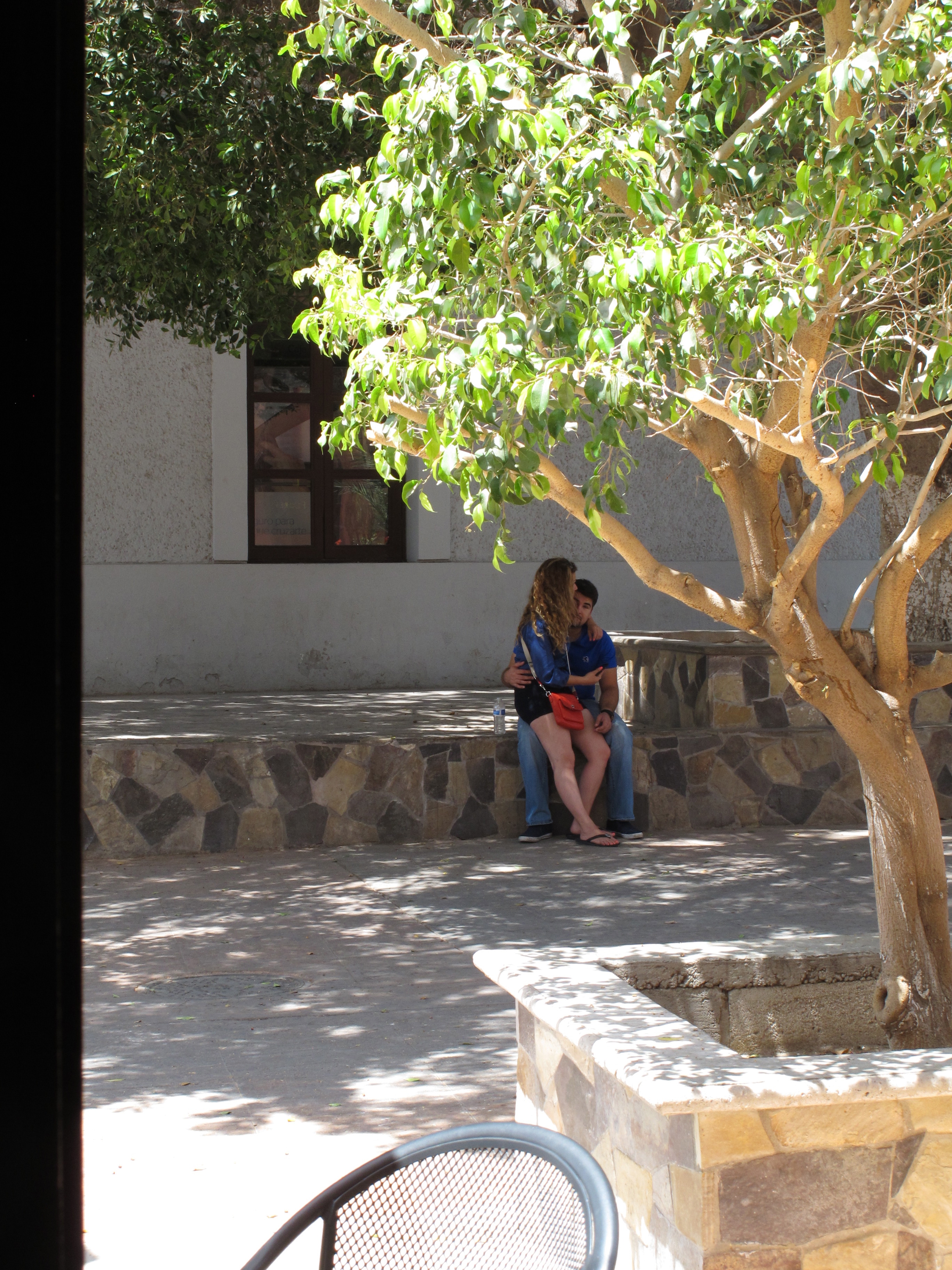
I spent a few hours at a wifi coffee shop in Loreto trying to pay some bills and update the blog. I wasn’t very productive since the wifi was so slow but all our bills eventually got paid. Darryl spent the time finding interesting images and entertaining the locals as they watched him photograph walls, windows and doors. 🙂

Doorway images
Doorway images
The frustrated blogger, nothing would upload on this slow wifi.
Lovers in Loreto
Lovers in Loreto

By early afternoon, we were ready to continue our trek north. We tried to eat at Rey’s before leaving Loreto but once again, the place was closed. It’s supposed to be the best tacos in Loreto but we have yet to taste them after four different attempts on four different days!

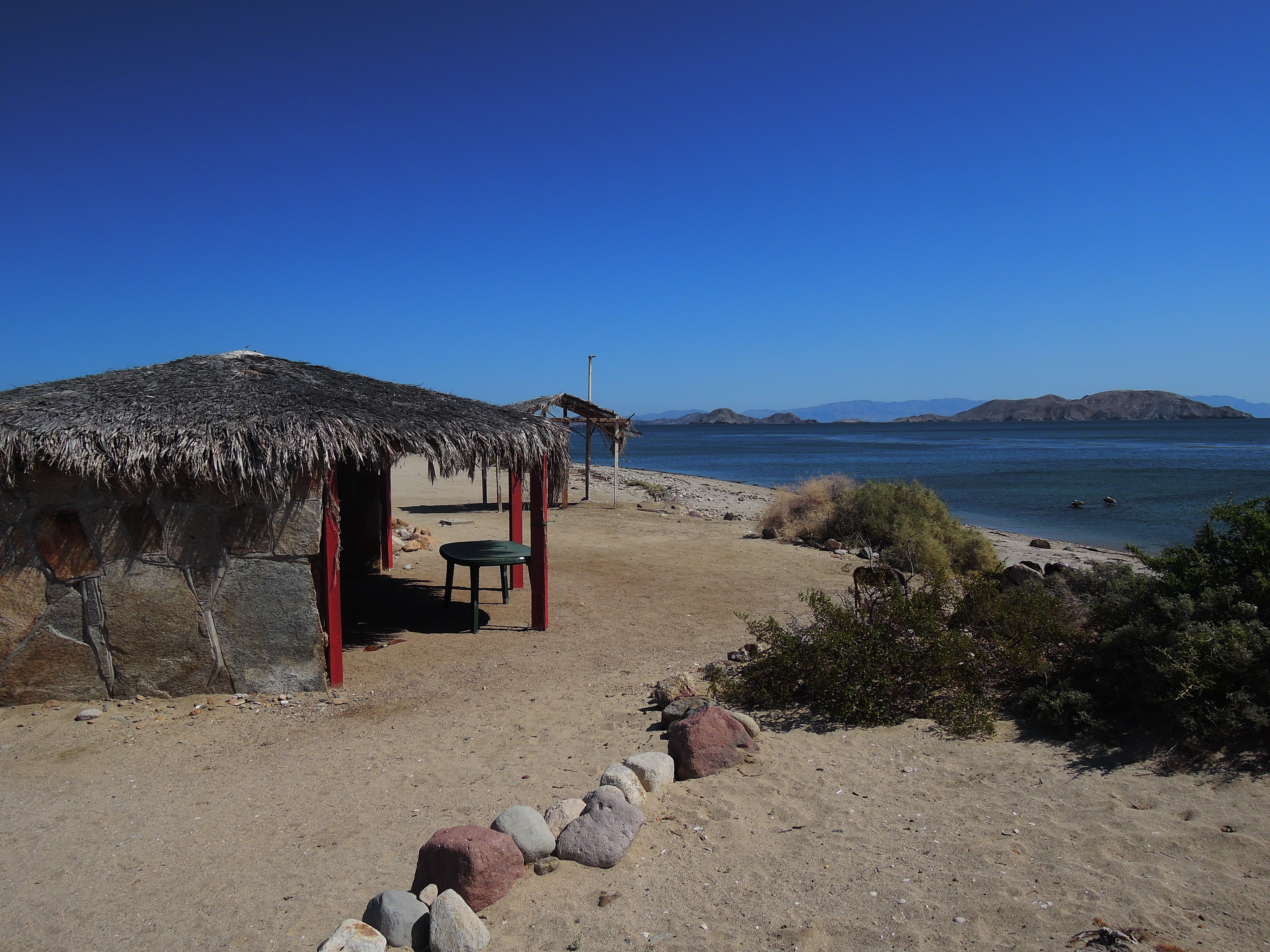
We were really looking forward to staying at this spit of sand on Conception Bay which was just a short distance up the road but it was Easter weekend which is a very popular holiday in Baja. Over the past few days, we were told on multiple occasions to be especially careful on the roads because everyone would be out driving to the beaches and there would be a lot of drunk drivers on the road. We stopped at every beach we could find along Conception Bay and they were all packed with families enjoying their long holiday weekend. This wasn’t what we had envisioned so we continued north to Mulege. We didn’t arrive until after 8 pm and it was getting dark. We drove into the campground where we stayed earlier and to our surprise it was closed for the season! With nowhere to go, we asked the other residents who lived nearby if they knew of a place for us to go and they told us to go ahead and set-up on the campgrounds. So we went from overly crowded beach options to having a whole campsite all to ourselves in the course of a few hours! We were extremely grateful for this turn of events.

Darryl filling up our ice chest.

The next morning we (Darryl) loaded up the cooler with ice and then continued along to San Ignacio where we would stay at the Kuyima Ecotourism camping grounds located along the San Ignacio lagoons where we saw the friendly whales posted earlier. When we arrived at the campsite, we were excited to see that we would have the place all to ourselves. Although it’s along the water, it’s on the Pacific side which was cold and windy. We were happy with the solitude but the price would be a windy night listening to the rain fly blowing all night long. Thankfully we will have ear plugs!

Our camp host invited us into the restaurant area so that we could get in out of the cold and wind. He also shared with us some amazing video taken earlier in the season of some scientists helping a grey whale calf that had fishing gear attached to its fin. Here’s a link to the story. It was pretty incredible seeing how they were able to get close to the calf by first slowing it down with a buoy and then getting near enough to cut the lines entangling the calf. We had a lovely evening walking along the beach enjoying the solitude.

Along the coast near Kuyima.
Sea shells, sea shells
Life is wonderful!
Life is wonderful!

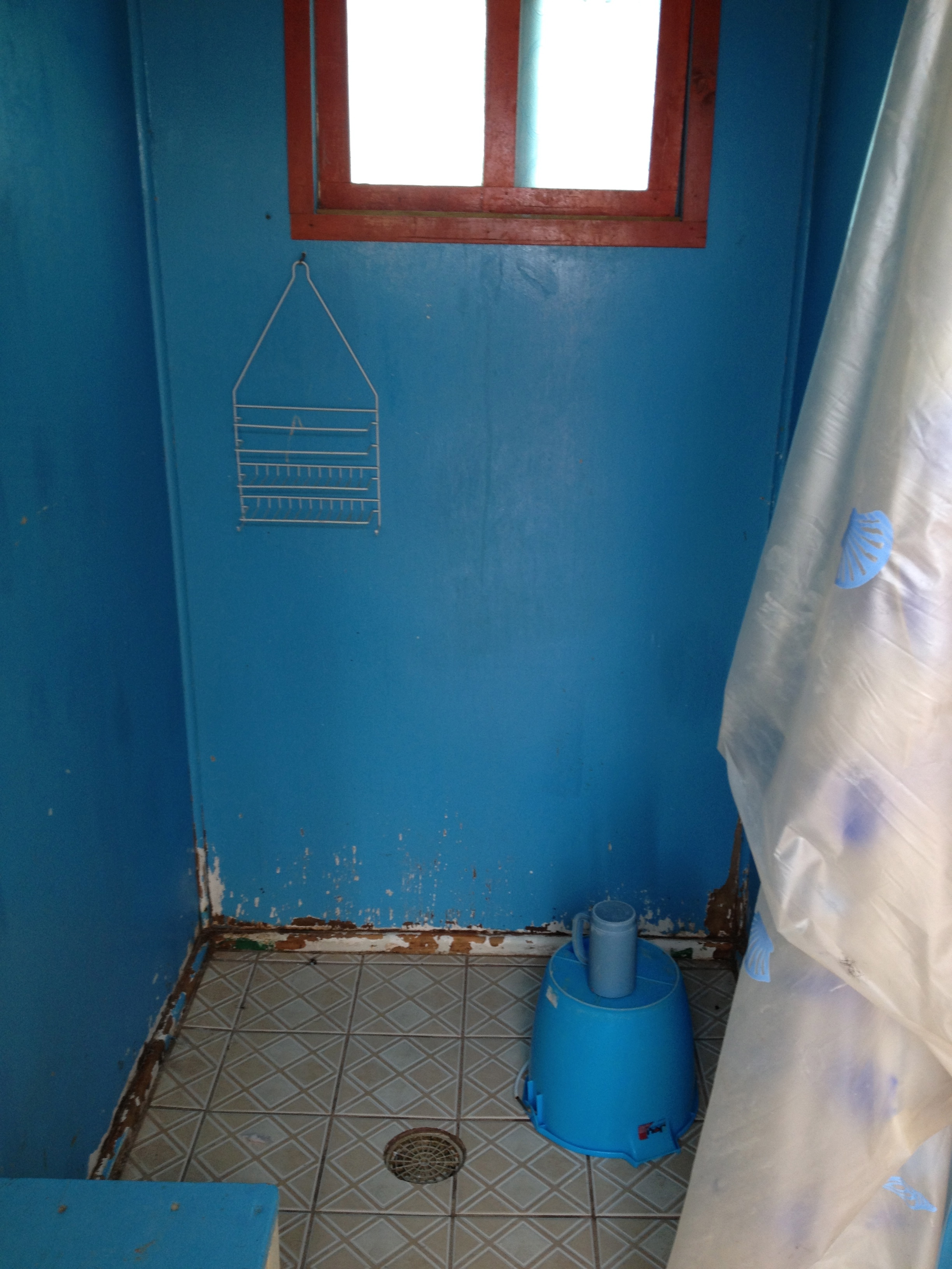
The showers at Kuyima were the most interesting that we’ve encountered yet on our trip. They use a solar system to heat the water in this large holding tank. They provide a bucket which you fill up from the hot water tank mixing it with cold water. You take this into a small shower stall where you’ll find a cup to use for pouring the water from the bucket over you as your shower. I was hesitant at first but the camp host talked me through the whole process and promised that it would be toasty warm in the showers and that the water would feel great. Given this was my only alternative, I gave it a shot and was amazed at how little water we actually need to use! This method is very similar to a “navy shower”. It got me thinking that perhaps we can incorporate these ideas into our home when we build it as a way to conserve water and energy.

The water was HOT in this solar heating set-up.
Fill up the bucket mixing hot with cold.
Our shower facilities at the eco-lodge.
Our shower facilities at the eco-lodge.We drove through Guerrero Negro with a short stop for lunch. Rosario was our next town

We drove through Guerrero Negro with a short stop for lunch. After this stop, we would be covering new ground in Baja! I was looking forward to this next section and seeing some new places. We expected to stay someplace near Cataviña which would mean driving 260 miles which would be one of our longer driving days. After the long drive, we were looking forward to settling in for the night. There were a few camping options so we set out to find a spot. The first place was closed, then the second place seemed deserted. I saw clothes hung out to dry so I knew there should be somebody around. After knocking on the door of every building on the site we gave up and continued along the road. Since we were getting low on gas, we drove to the next fuel station on the map located in town only to find it closed and deserted. There happened to be a pick-up truck on the side of the road selling fuel out of the back but  we didn’t want to risk putting questionable fuel into the FJ. We asked around the town where we could find gas nearby. It would be another 70 miles before we could find more gas so we sucked it up and bought 2 gallons of “gas” from the couple at the pick-up truck. They were well positioned at exactly the spot where people would be running out of gas on this long stretch of highway! It cost us $6/gallon for this error plus whatever potential engine issues we might have to deal with in the future.

Now with enough fuel to get us to El Rosario we set out to find a place to camp for the night. Our long day of driving turned into a

Pretty direct messaging at El Rosario campsite.

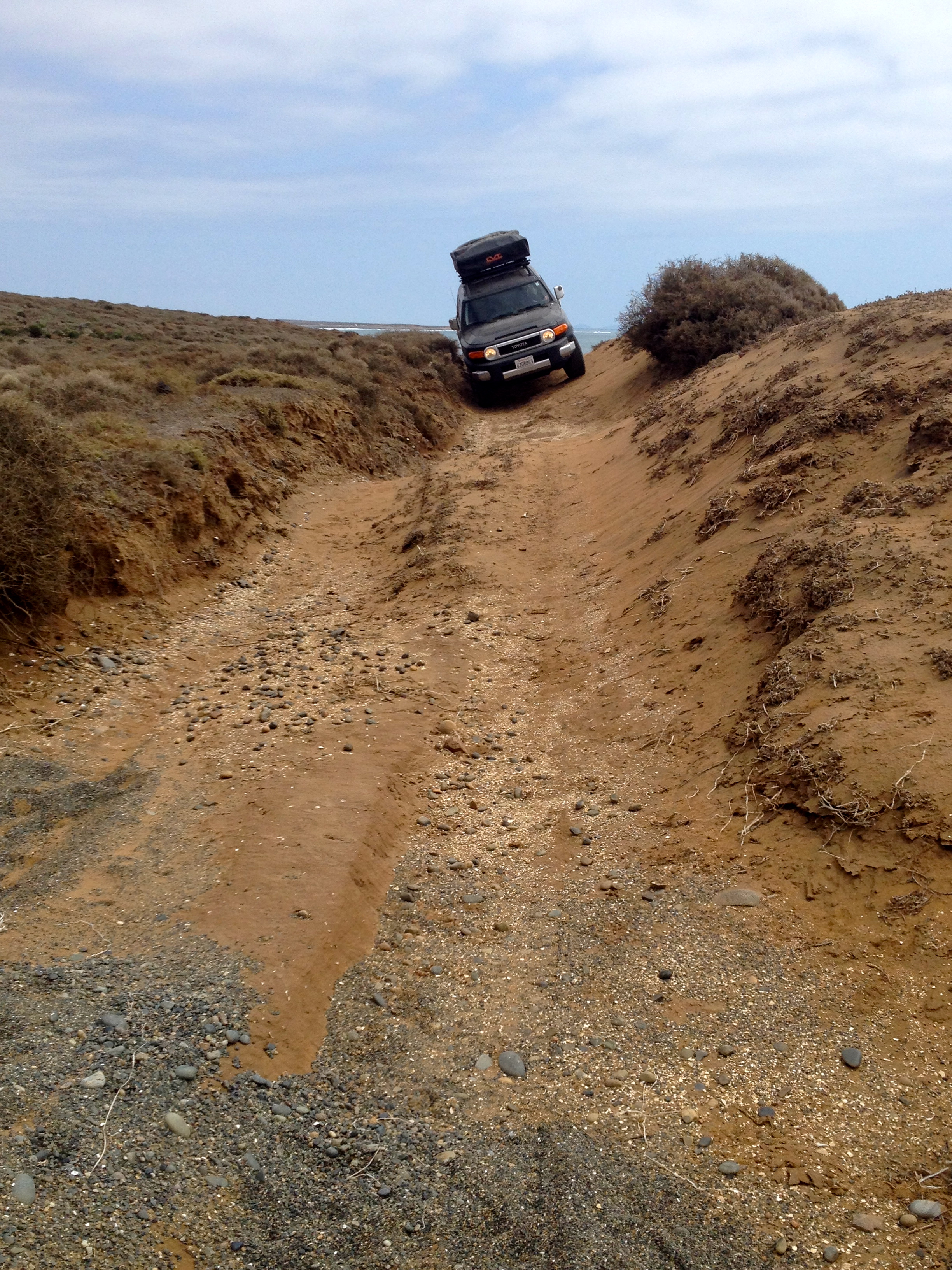
very long day. We broke another of our rules and drove during the evening to make it to town. There wasn’t much that interested us in El Rosario so we left the next morning for San Quintin where we spent the day along the water and Darryl had a little fun taking the FJ along a dirt path near the edge of the cliffs. I got out and took photos since he would be passing too near the cliff’s edge for my comfort!

Darryl's first test drive of FJ in off-road conditions.
Darryl’s first test drive of FJ in off-road conditions.
That's about a 100' drop there!
Note how close the tire tracks are to that edge! That’s about a 100′ drop there!
He loved it!
He loved it!
We found an interesting shipwreck along the beach.

There were miles and miles of greenhouses all throughout this area that receives less than 10″ of rainfall per year. The intensive agricultural industry in the region has resulted in the aquifer dropping about a foot per year allowing the sea water from the Pacific Ocean to intrude into the aquifer. The ancient aquifer is expected to be used up within the next 10 years. The produce from these farms is shipped to the US making me wonder where our cheap food will be sourced in the future.

Green houses stretched for miles along the roadside.

That evening, we stayed at Meling Ranch which was recommended to us by Lynn and Ed from the Guerrero Negro whale watching tour. We had a lovely evening at the ranch among the mountain scenery.

Approach to Meling Ranch.

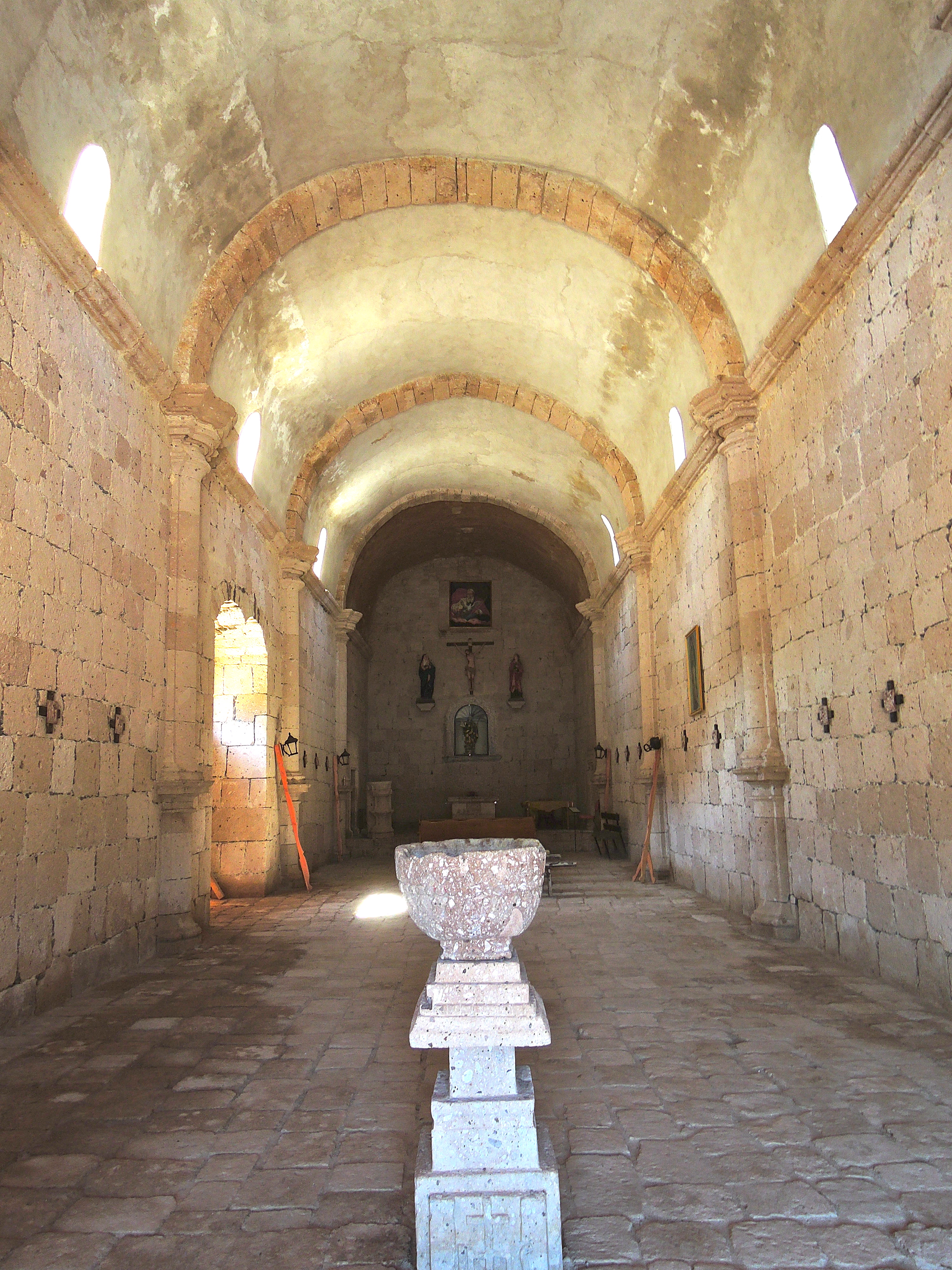
We took the tour of the Observatory the next day. It was located high in the mountains of the Sierra de San Pedro Mártir.

Observatory at San Pedro Martir National Park.

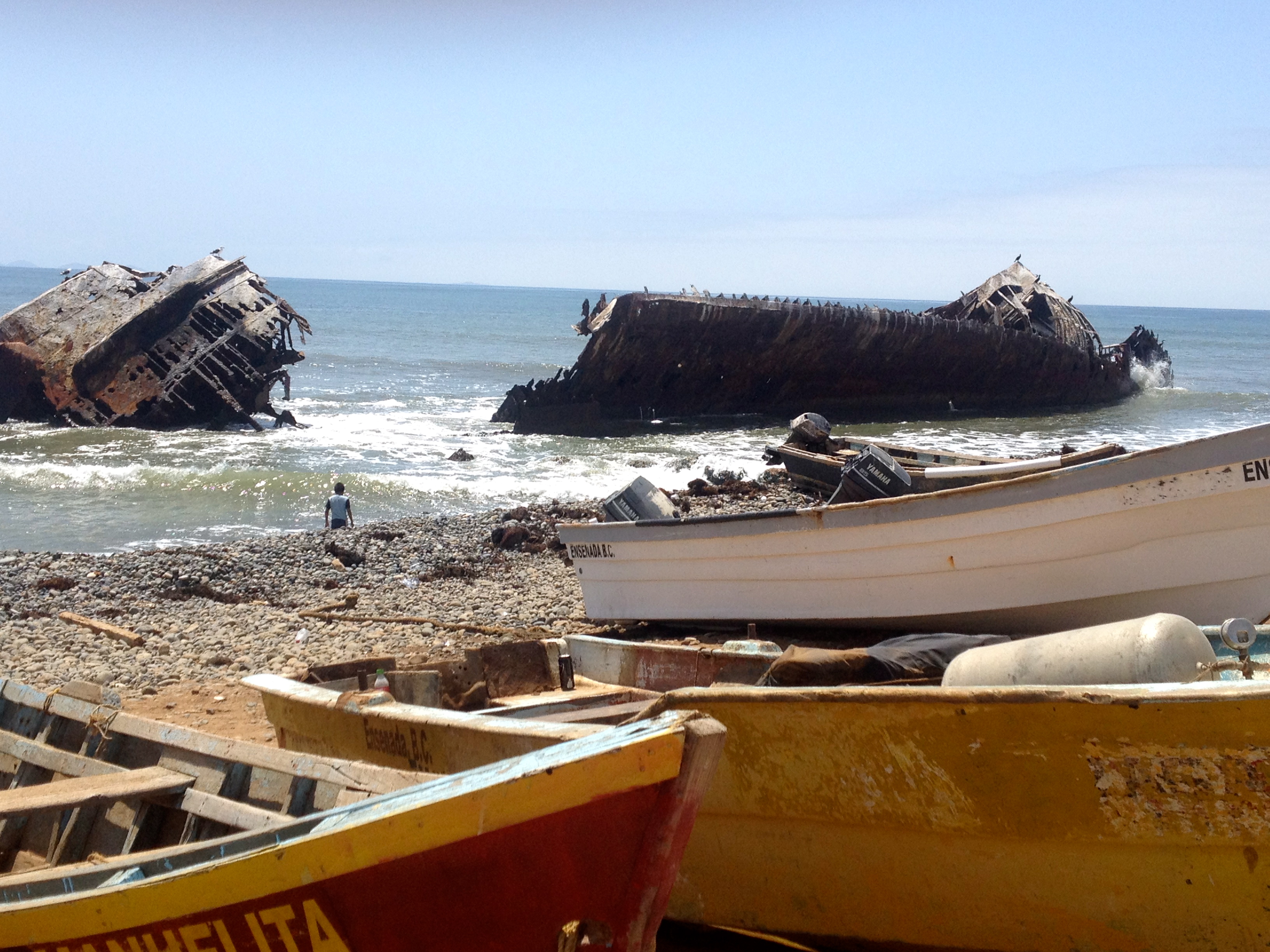
Our last stop in Baja before crossing the border would be Ensenada. Before checking in at our next “campground” in the city, we stopped at La Bufadora which is one of the largest blow holes in North America. To get there, we had to walk through a long line of vendor stalls selling all sorts of trinkets, food, sweets, photos with exotic animals, and who knows what else.

Running the gauntlet of vendors at the Bufadora near Ensenada.

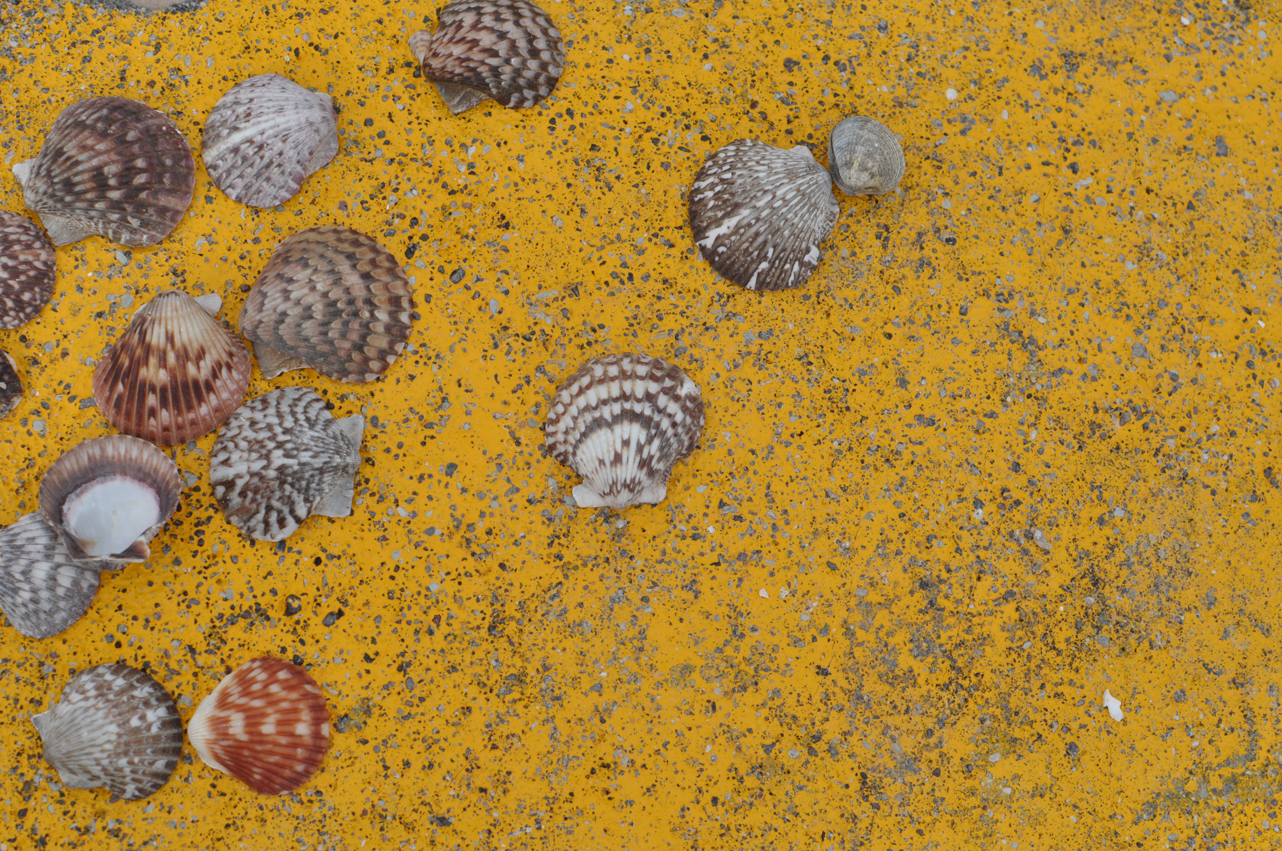
After a loud night at the Ensenada campground, we stopped at the fish market in the morning and then had our last tacos before crossing the border.

Fish stand. The english translations were helpful.
Our last tacos in Baja.

There was a HUGE line of cars, campers and trucks waiting to cross the border. It was hot and there were vendors making their way up and down the line of traffic selling cold drinks and other snacks. We’re all patiently waiting our turn when some idiot drives up along the line of cars and forces his way in front of a camper. There were some words and gestures exchanged but the intruder held his place. Darryl and I commented to each other about what jerks people can be and how frustrating it is that they get away with that behavior all the time. To our delight and entertainment, we watched as a border agent came along with lights flashing and pulled the cutter out of the line and escorted him all the way back to the end! What a lovely way to end our incredible journey throughout Baja!

More whales from Guerrero Negro

Thanks to Ed & Lynn for sharing these photos of the whale watching tour at Guerrero Negro. We really enjoyed spending the day with them. You can click on any image to enlarge it for better viewing. 🙂

Arte Rupestre…a.k.a. Pictographs

We arrived late in the evening at Hacienda de la Habana, our campsite in Mulege.

Our new home for the night.

This place is near the edge of town with a seemingly complicated set of directions down unnamed dirt roads but it’s well worth the extra effort plus, there are signs at every corner for the camp’s restaurant, Ray’s Place.

Very tasty fruit
Our welcome gift!

We stayed here for three nights but the restaurant was never open during that period. We did have some fresh fruit picked for us by the grounds keeper. The business hours were a little hit or miss at many of the restaurants and other small stores all throughout Baja. It was very common for places to be closed for most of the week with nothing indicating when they might be open.

Very tasty fruit!
Very tasty fruit!
We really loved the style of this home on the campground.

The next day, we arranged for a tour guide to take us to the “arte rupestre” which are the petroglyphs that are found at various sites throughout the Baja peninsula. A certified guide must accompany tourists at the La Trinidad petroglyphs. Ours would be Salvador Castro Drew of Mulege Tours.

This pony seems to know where he belongs.

The rest of the day was spent enjoying the scenes of the small town of Mulege and hanging out in the local café with “almost free wifi” which meant that we just needed to purchase something to use their internet. I finally posted my first blog on this day!

We met our guide Salvador the following day for a full day of easy trekking through the mountains along with a family of three from Florida.

This is one of the handful of springs that were along the trail.

Our tour included a stop along the road where we could get our photo taken next to a giant cactus. Salvador told us about the medicinal and other practical uses for the various plants of the region. At the beginning of the tour he said that with the knowledge that he was about to share with us we would be able to survive out in the Baja desert. There were plants that could cure ailments of the stomach, liver, or colon; cure headaches and potentially cure cancer. He showed us anti-coagulants to stem any bleeding. We learned about mushrooms used as food and another used by the priests for their visions. After our survival training, I can confidently find water in a barrel cactus and then use the leaves of the creosote bush to eliminate my foot odor. All of the other pearls of wisdom were forgotten by the time we returned to the van to continue the tour.

Here we are next to the giant cactus.

Salvador had a wealth of knowledge about the local petroglyphs and the history of our very limited knowledge of this arte rupestre. The petroglyphs in the area have been dated to between 2,000 and 7,500 years old but this is still debated. Ancestors of the now extinct Cochimí Indians or Guaycura Indians were the likely artists of the La Trinidad area. Nobody really knows the meaning of this ancient artwork but there are many guesses.

Salvador told us how the last links to our understanding of these ancient people were lost after two events; the extinction of the native Cochimí Indians and the exile of the Jesuits from the Baja Peninsula by King Carlos III of Spain. According to Salvador, the Jesuit missionaries gained the confidence of the Cochimí Indians. The Indians began to share with the Missionaries their knowledge of the area and about its history including what they knew of the petroglyphs. Some believe that the Cochimí ancestors may have been the artists some hundreds of years earlier but the meaning and purpose of the petroglyphs was lost through the generations.

The Jesuits were meticulous in their documentation of the land, the people, the geography etc. They documented what was told to them by the Indians but upon learning of their impending exile from the peninsula by the Spanish crown the missionaries destroyed their writings rather than leave them for the benefit of the Spanish. Only a few documents remain from the Jesuits describing some of the petroglyphs in the southern part of the peninsula.

The figures that we saw were of the animals that were hunted (deer, turtles, fish), figures of humans, perhaps their shaman, and hunting figures, hands, and other unknown figures.

These were likely children’s handprints. Reminds me of some artwork that I did in kindergarten!
There were many drawings of deer, some of them had spears sticking out of them.
This looks like the result of a successful hunt.
Some fish and turtle figures.
Animals with lines through them were common.

Throughout the La Trinidad area, archeologists uncovered artifacts of early life among these ancient people.

Grinding stones
Grinding stones

Our tour ended at the Mission Santa Rosalía in Mulegé. This mission was founded in 1705 by the Jesuits and taken over by the Franciscans in 1768 after the expulsion of the Jesuits from Baja. It ceased to function as a mission by 1828. Today, there is a priest that will come to the mission and conduct mass at times and there are weddings that will take place here. This mission has been completely restored but retains some of the original stones.

View of the outside walls.
The mission was very small but charming inside.
I loved the varied doors around the mission.
And door #2. :-)
And door #2. 🙂
Front of the Mission.

We ended our tour overlooking the beautiful little river that runs through town surrounded by date palms.

Santa Rosalía River
Santa Rosalía River


Coco’s Corner, a Magical Forest and a Mission

Continuing south toward the Bahia de los Angeles we passed through Coco’s Corner. This is a must see for fans of the Baja off road races. The roads out to Coco’s Corner were all dirt, rutted and potholed. Darryl was in charge of driving at this point and I was free to enjoy the beautiful desert landscape. Coco is a legend in the off road racing scene and a jovial host. Everyone who says hello to him has to sign his guest book, which is massive, with their name and birth place. He is very particular about this point of birth place.

Image

At Coco’s we met Raul who told us about Campo Archelon in Bahia de los Angeles. He’s been staying there for years and was very enthusiastic about the location. After sketching a rough map to Campo Archelon in the dirt he told us about Antonio, the owner, who was a turtle researcher in a previous life.

After meeting Coco, signing our names and birth place to the guest book, taking photos of the panties hanging from Coco’s ceiling and cool “bad ass” vehicles in the lot we headed back down the road.

Motorcyle hanging outside Coco's.
Motorcyle hanging outside Coco’s.

After a day’s drive through the desert, the view coming into Bahia de los Angeles was absolutely stunning with its aquamarine colored waters dotted with islands.

Campo Archelon
Campo Archelon…we made it!

We referenced our mental notes of the map to Campo Archelon and arrived at a neatly kept campground originally established as a turtle research center. Our hosts, Antonio and his wife Bety Resendiz, were the first to establish the migratory path of loggerhead turtles in 1995 when a 213 pound turtle they tagged was found off the coast of Japan by local fishermen.

Antonio's and Bety's beautiful home at Campo Archelon.
Antonio’s and Beti’s beautiful home at Campo Archelon.
Signs we saw along the way in Bahia de los Angeles.
Another signpost dispensing more good advice.

The next day I awoke just before sunrise and enjoyed the changing palette of purples and pinks across the horizon. I’m not a morning person but this beauty is worthy of seriously considering a change in routine.

Beautiful sunrise
Beautiful sunrise
Taken just as the sun was peeking over the horizon.

After breakfast, we spoke with Antonio about scheduling a boat trip out on the bay with his neighbor’s son Angel. Within 30 minutes Angel was ready to take us out in his boat for a little fishing.

We were told by Angel that they fish for ahi, mahi, barracuda, grouper and sea bass among other fish. We trolled for bait by dragging this six inch lure behind the boat at speed. With no luck at trolling for bait fish, Angel decided to stop and fish a couple of spots until we got lucky and caught a small grouper. He cut it up for bait and I fed the head and spine to the pelican that was begging for a little taste.

Darryl was given a pole with two hooks on it. No sooner had he dropped the baited hooks into the water then he was pulling up TWO fish, one on each hook! Wow! After maybe 10 minutes, Darryl was pulling up another! All grouper, but we were having fun pulling them out of the water!

Our guide in search of Moby Dick.

Angel had a bit of Ahab in him so we went in search of another fishing spot to find something larger. Darryl eventually hooked something large enough to bite off the bait and the 6-inch lure! I wonder how that fish is feeling now with all of that metal in his belly. We didn’t hook anything else but Darryl’s catch made for a nice dinner. The wind picked up and we headed back. We were in for another windy night in the tent.

Antonio's map to the magical forest.
Antonio’s map to the magical forest.

The next day Darryl asked Antonio for advice on what to see on our way toward Guerrero Negro. Antonio drew us a map to Mission San Borja with a side trip to a “magical forest”. The path was along mostly unmarked dirt roads that were not on our map but we had a full tank of gas, plenty of water and a sense of adventure so off we went with map in hand to find what we could find.

As we were driving along the road, we felt transported into a Dr. Seuss book. The forest was full of boojum trees, elephant trees and cardon cactus. Eventually we came to a sign indicating that there were ancient cave paintings in the area. We got out to take a look around but what we found were only a few drawings along one of the walls. They weren’t very impressive so we got back into our car and retraced our path to the start then continued on toward Mission San Borja. We later learned that we were just a few yards from some caves where the real masterpieces were located! If we make it back we’ll definitely make the trip again to see them.

Dr. Seuss boojum trees.

The road to the mission was pretty rough and there were some steep sections that required 4WD. Atfter 20 miles of all dirt roads with no signs indicating whether we were on the right path we finally started to see some small hand-painted signs telling us that the mission was up ahead. This made me feel more comfortable.

Antonio told us that there is a couple that lives at the mission, Jose & Alicia, with their children and grandchildren. We were greeted by Jenaro, one of their children, when we arrived. The family is descended from the Indians that worked there when it was first founded in the 1500’s and have worked the land for generations. Jenaro gave us a tour of the mission and the surrounding spring fed garden. The garden, first planted by the missionaries, still yields figs, lemons, limes, pomegranates and grapes descended from those planted in earlier times. The family also has small herds of sheep, goats and cattle that roam the mountains and they have a few horses used for rounding up the small herd of cattle.

Jenaro was generous with his time sharing with us what life is like living in this paradise. He was home schooled for most of his primary and secondary education and is now in his 4th year of University studying archelology. Given the oral history of his family and a lifetime of exploring the caves full of ancient cave paintings, he has a wealth of practical knowledge that is supplemented now by the University. We hope to return for another visit later in the year to stay for a few days exploring the area with him.

Some details about the Mission.
DSCN1099
A look inside the mission.
DSCN1110
A view of the Mission and the beautiful mountain backdrop.


First days in Mexico

Our border crossing into Mexicali was uneventful. We went through the eastern-most border crossing after reading that there would be less traffic. The US border patrol seemed to be more interested in why we were going into Mexico than the Mexican border patrol who just waved us along. Once through we stopped to get our tourist visa and then we were on our way!

Our first stop was San Felipe, 125 miles south of Mexicali on Mex 1. The roads were easy to navigate and I faithfully followed the speed limits while all of Mexico sped past me. I didn’t want to encourage a meeting with the Mexican police.

We arrived at San Felipe in the late afternoon and chose Playa Bonita RV campground after visiting the four available campgrounds along the beach just north of town. After setting up camp, Poncho, the camp manager, drove us down to the main strip and gave us a little tour of the place along the way. It’s a tiny town with only two main streets so the tour was very short.

We found a really tasty taco stand at the south end of town. If you’re in San Felipe, stop by. It’s the only stand where they were cooking the food along the sidewalk with tables and a bar set inside the building. They had amazing grilled chicken and pork al pastor (roasted on a vertical rotisserie). We don’t remember the name but you can’t miss it.

Given all of the driving to this point, we decided to stay another day in San Felipe. It was a pretty little town and our first place along the Sea of Cortez. We walked to the Centro to get something for lunch and decided on another popular looking restaurant. When choosing our restaurants, we favor the ones that have more local patrons. Given our waiter’s limited English, I was forced to try out my broken Spanish with mixed results. I thought that I ordered 4 items but we ended up with two additional items and potentially more on the way when I finally told him…basta! enough! Nada mas!

The next day we continued south along the Sea of Cortez toward Puertocitos. We stopped at the Valley of the Giants to see the Giant Saguaros. In 1992, Mexico sent one to Spain as a gift in commemoration of the 500 year anniversary of the discovery of Mexico. These giants grow to over 10 tons and live to be more than 2,000 years old. They don’t sprout their first arm until they are around 75 years old. Of the more than 40 million seeds it produced in its lifetime, maybe one will survive to maturity.

DSCN0944
I’m almost 6′ tall and am dwarfed by this giant.

DSCN0951When we arrived at the Valley of the Giants, we were met by an engaging gentleman who was busy lassoing a cow skull. We paid him the entrance fee of USD$10 and he pointed us in the direction of the giants. We drove along until the sandy road became too deep for our comfort then headed back out to continue our journey to Puertecitos.

On our way into Puertecitos, we noticed a little shack on the side of the road named Cowpatty.

10 Bucks to whomever guesses what the green thing is in the car!

We made a mental note of the restaurant but went to Puertecitos first, hoping for some other options. We asked the hostess of the campsite in Puertecitos about other food options and the prices for camping and soaking in the hot springs. There was no food to be had and the prices for camping and the hot springs were more than we wanted to pay. We were pretty hungry so we decided to go back to Cowpatty and figure out our next move. For once, I held my expectations in check. With a  name like Cowpatty, who knows what could be in store! Well, they only had hot dogs, chips and soda or beer on the menu. I think this was my first hot dog in over 5 years!

After we finished eating one of the customers told us that there was a good restaurant down the road just past Puertecitos called Christina’s. Great timing! If only he had mentioned that about 5 minutes earlier. 🙂 So Darryl and I got back in the car with fingers crossed, hoping that the restaurant would be open. When we arrived, we saw that the three motorcyclists that passed us earlier and were also at the Puertecitos campsite were there as well. They invited us to sit with them and we had a wonderful dinner sharing stories about our travels, the planning and where we were headed. They are also on their way to the southern tip of Argentina. Check them out at www.3upcollective.com.

After dinner, we decided to stay at the beach in front of Christina’s restaurant. Check out our penthouse view! We thought we had the place all to ourselves until a litter of coyote pups woke us up at about 3 am. What a rough life but I’ll take it!!

DSCN0970
Sunset on our beachfront site.